A Land of Changeable Terrain and Weather
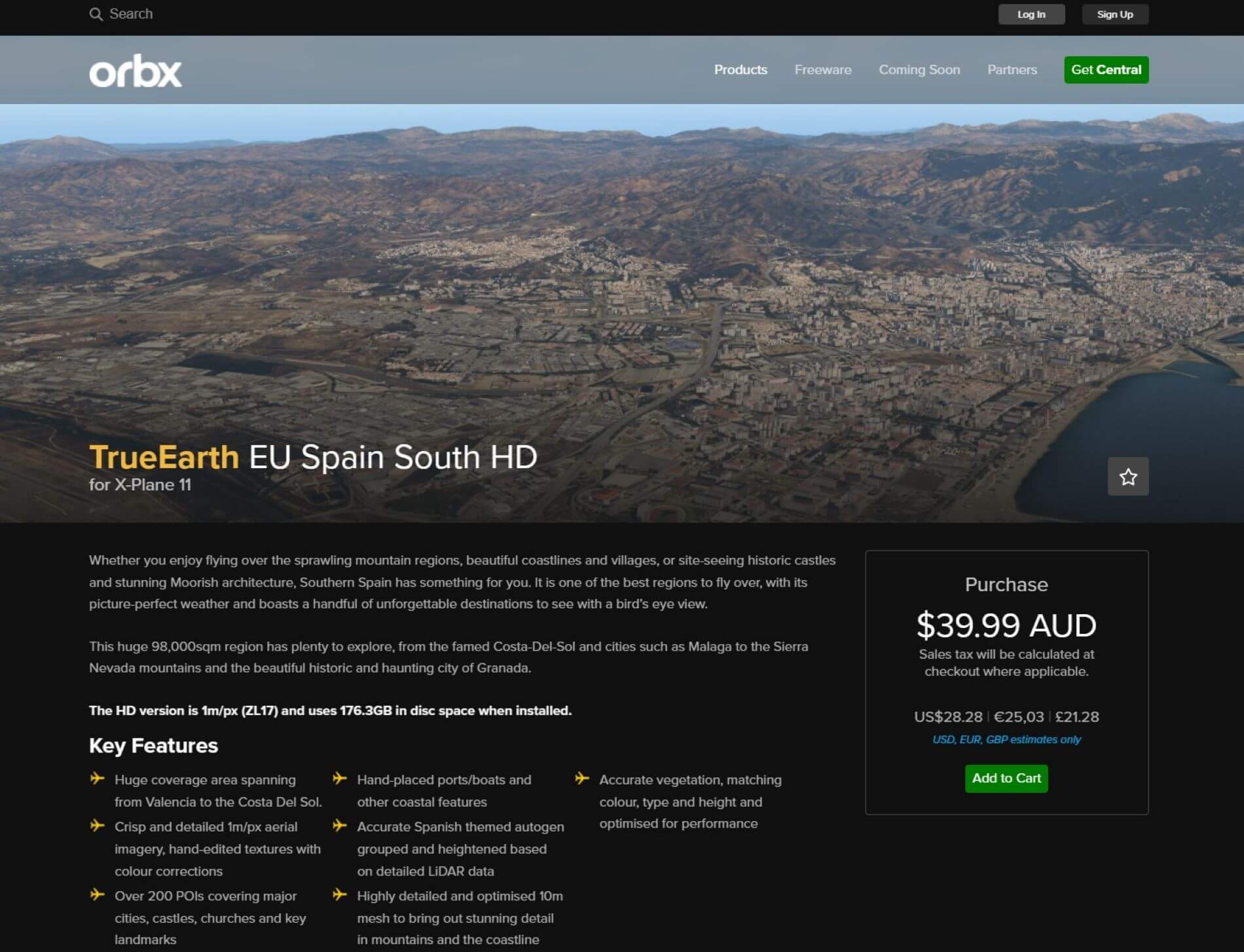
Orbx TE EU Spain South (HD Variant)
Welcome to southern Spain brought to X-Plane courtesy of Orbx Systems. This review is for the HD variant of the package and is done from the perspective of the General Aviation pilot flying low and slow and using landmarks for VFR pilotage. This point of view has been chosen because it is a balance between getting too close where the orthophoto loses its effect and passing over at the lofty heights of larger aircraft where the impact of the individual points of view models as well the autogen can become lost to view.
As with any add on to the X-Plane universe, this adventure begins with installation and setup.
Installation and Documentation
The scenery package can be purchased through the Orbx web site or through the Orbx Central application. Oddly, the package is not the featured package when Central is launched and does not display anywhere on the opening screen. The user must select Europe from the menu bar and then choose EU Spain South HD (or SD). Regardless of how it is purchased, installation will always be through Orbx Central.
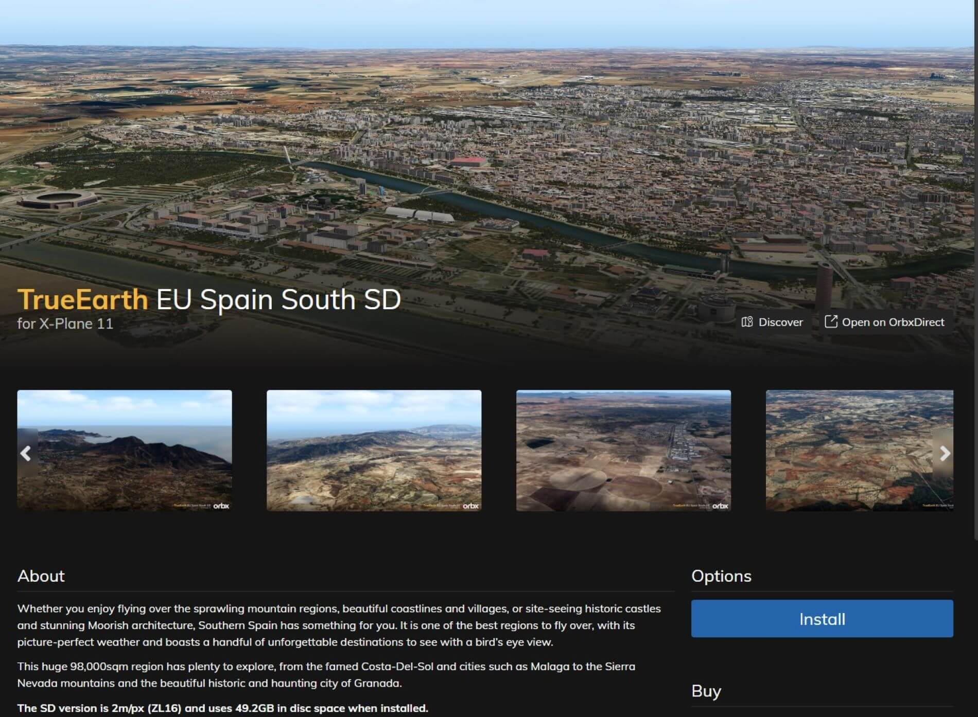
Once the purchase is completed, the blue Install button is used to begin the download, extraction, conversion, and installation process that can take a substantial amount of time depending on hardware limitations. It is a download of 53.72 GB and requires 176 GB of space on disk. The SD variant is substantially smaller at 49.2 GB when installed. The package can be installed in a designated library that does not have to be in the X-Plane folder but, if you have more than one installation of X-Plane, you will need to be sure you have selected the proper one by using the X-Plane button at the top right of the screen.
When the installation is complete, there will be a red uninstall button on the screen. There will also be User Guide and Support buttons. There is no User Guide and Support takes you to the Orbx web site where you can enter any issues or concerns that you need help with. Not as noticeable is a small white “Configuration” button. Clicking on this takes you to where you can choose to turn of the default X-Plane roads for natural roads. The traffic still works as it normally does. Once you have done this, your installation is complete.

Once installed, your Mediterranean adventure can begin.
Overview
True Earth EU Spain South covers about 98,000 square miles. The area includes the Autonomous Communities of Andalucía – the largest complete area – Murcia, parts of Valenciana, Extremadura, and Castilla-La Mancha. Major cities in this area include Valencia, Alicante, Murcia, Málaga, Granada, Seville, Merida, and Toledo. Though not one of the larger cities, Benidorm (on the coast in Valenciana) cannot be overlooked for its iconic buildings.
This map – a screenshot of Alexander Barthel’s Little Navmap – shows the geographical territory that will host your flights.


Given the large area involved, this review will focus on the major metropolitan areas and a couple of the predominant landscape features. As with any Orbx True Earth project, attention will be focused firstly on the terrain since this is the biggest reason for obtaining the package. This will be followed by a look at the iconic architectural features (certainly not all of them since a lot still need to be discovered) and the autogen.
Why not just use self-made Orthophotos?
There is a pretty good chance that, even if you’ve only been around the X-Plane world for a short time, you’ve come across discussions about satellite imagery or orthophotos as they are often called. The basic idea is that the default ground scenery can be replaced with ground scenery that is from satellite or aerial imagery which provides for a more realistic experience while flying since what you see below is from the real world.
One of the problems with this is the quality is entirely dependent on the available photo imagery. In many areas, this becomes a real problem because the photography is of poor quality due to the inclusion of clouds, noticeable shifts in color tone, bleached out or dark areas, and simply unavailable images at a high enough resolution to seem realistic. This is where the Orbx True Earth series of projects has stepped in.
The Orbx Approach
Orbx utilizes aerial imagery that is licensed for commercial use. The expectation is that the quality of this scenery should be better than what is available for individual use at no cost. Additionally, Orbx adds an overlay to the scenery comprised of scenery specific autogen that is laid out based on LiDAR data, and high resolution, individually modeled points of interest.
Just for those who aren’t familiar with LiDAR. LiDAR, which stands for Light Detection and Ranging, is a remote sensing method that uses light in the form of a pulsed laser to measure ranges (variable distances) to the Earth. These light pulses – combined with other data recorded by the airborne system – generate precise, three-dimensional information about the shape of the Earth and its surface characteristics. Check out the National Ocean Service.
This should result in buildings being accurately placed and of the correct height for that placement. All of this is built on a detailed 10m mesh to enhance the geographic details of coastlines and mountains. (In this package there is at least one island that does not exist in the X-Plane mesh that is now appropriately there.) Lastly, Orbx states they match the vegetation color, type, and height to match the vegetation shown in the aerial imagery.


TrueEarth EU Spain South
So, how does all this work out for southern Spain? Let’s have a look.
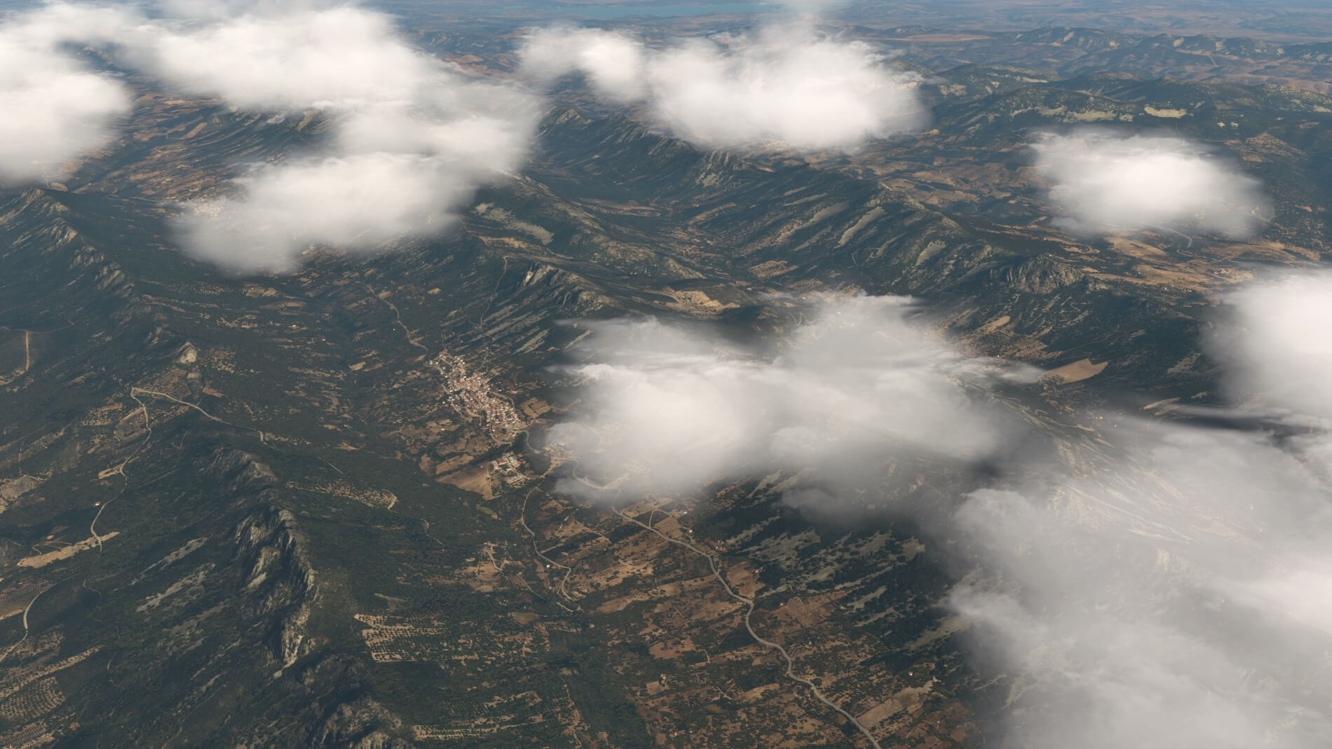
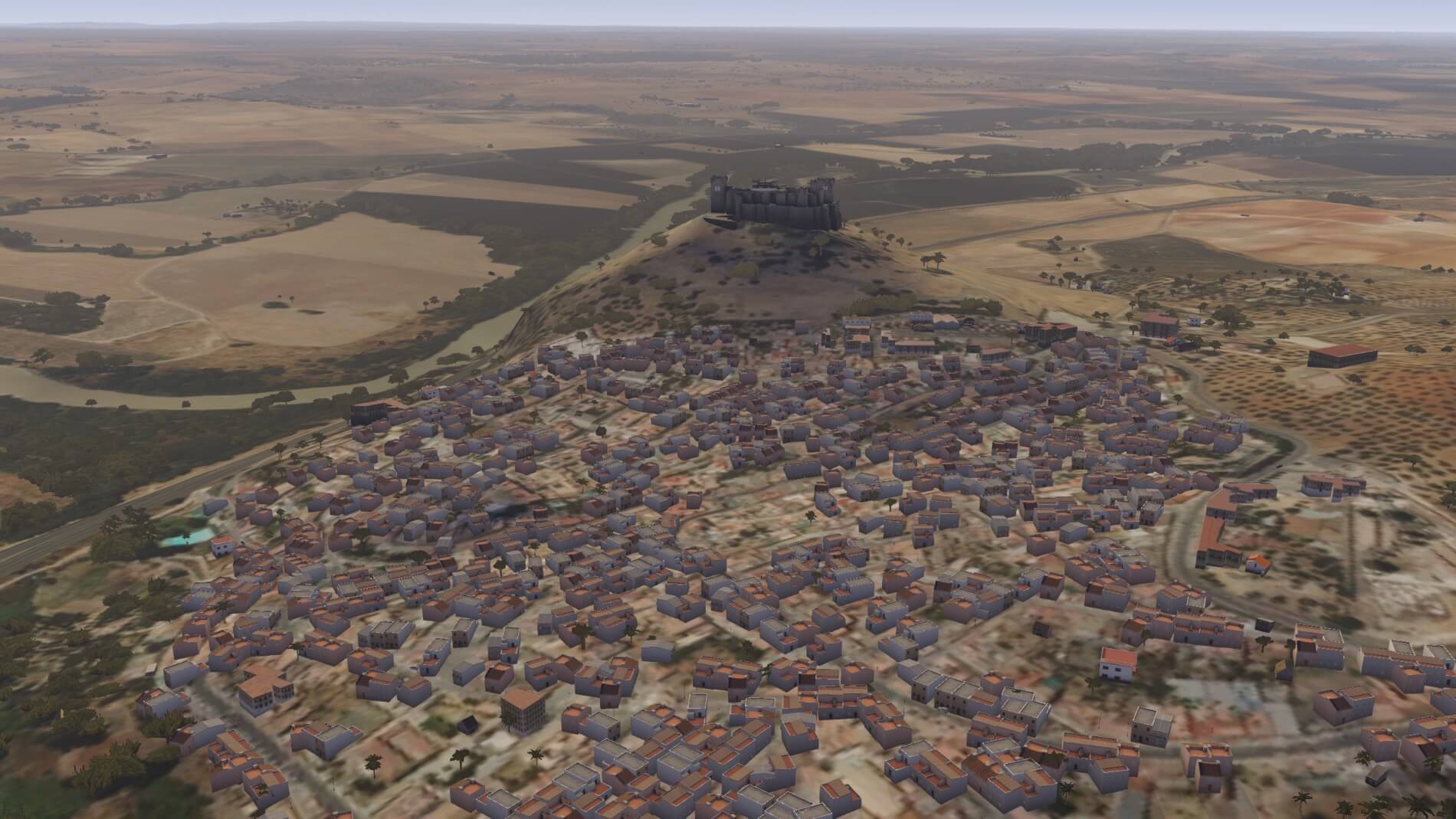
Flying around southern Spain reveals a few different terrains. The most obvious, especially from the south coast, are the Sierra Nevada mountains with their pine forests at the higher altitudes. Next, given that the area touches upon three different bodies of water, there are many miles of coastline. Moving up into the Seville area, there are plenty of flat, open, barren, and dry spaces that reach the hottest temperatures in Spain. The area also features fertile valleys, river basins, and the Andalusian Steppes of Granada at the base of the Sierra Nevada.
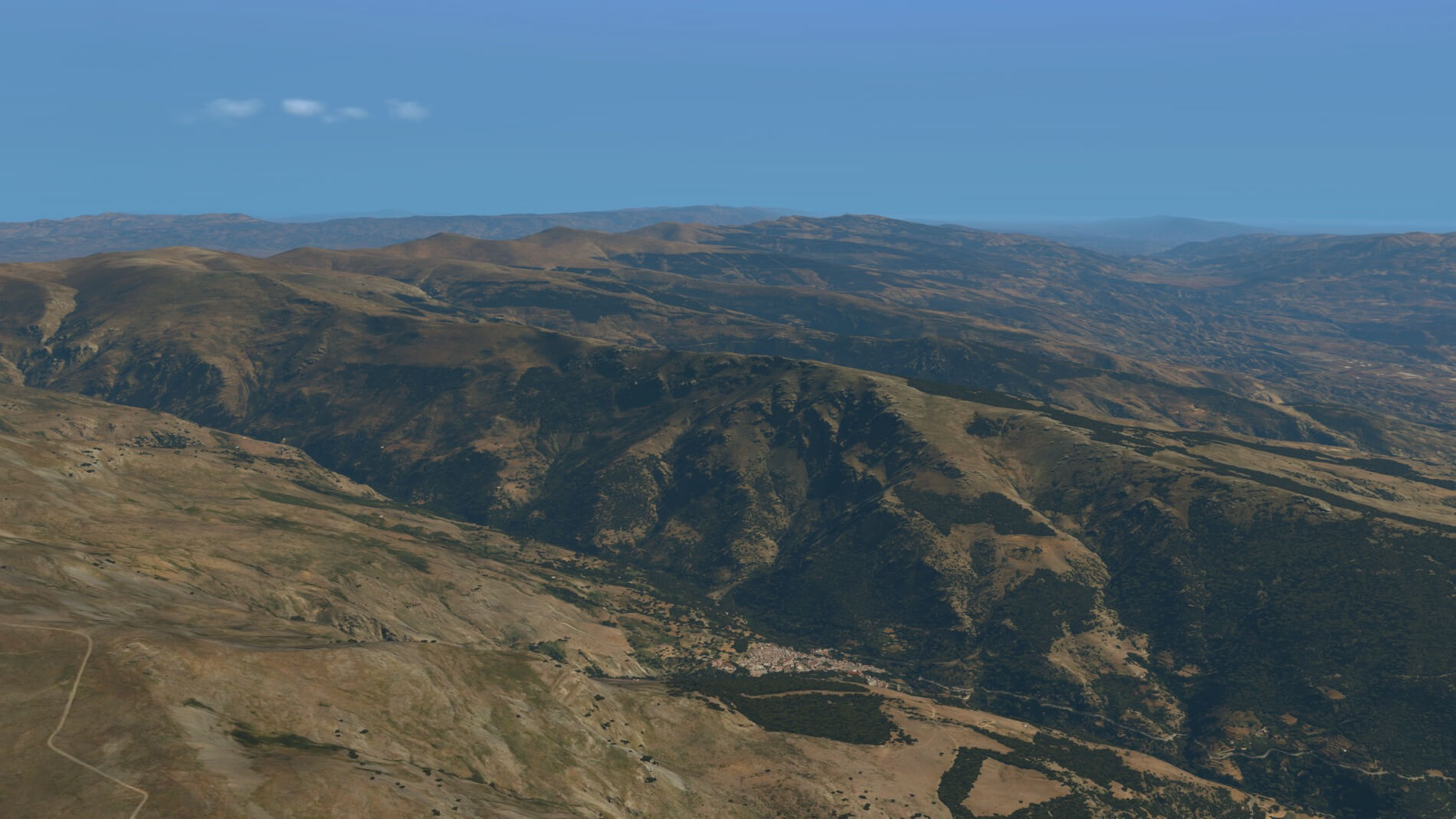
Sierra Nevada Mountains
Sierra Nevada is a mountain range in the region of Andalucia, in the province of Granada and, a little further, Málaga and Almería in Spain. It contains the highest point of continental Spain: Mulhacén, at 3,479 metres above sea level.
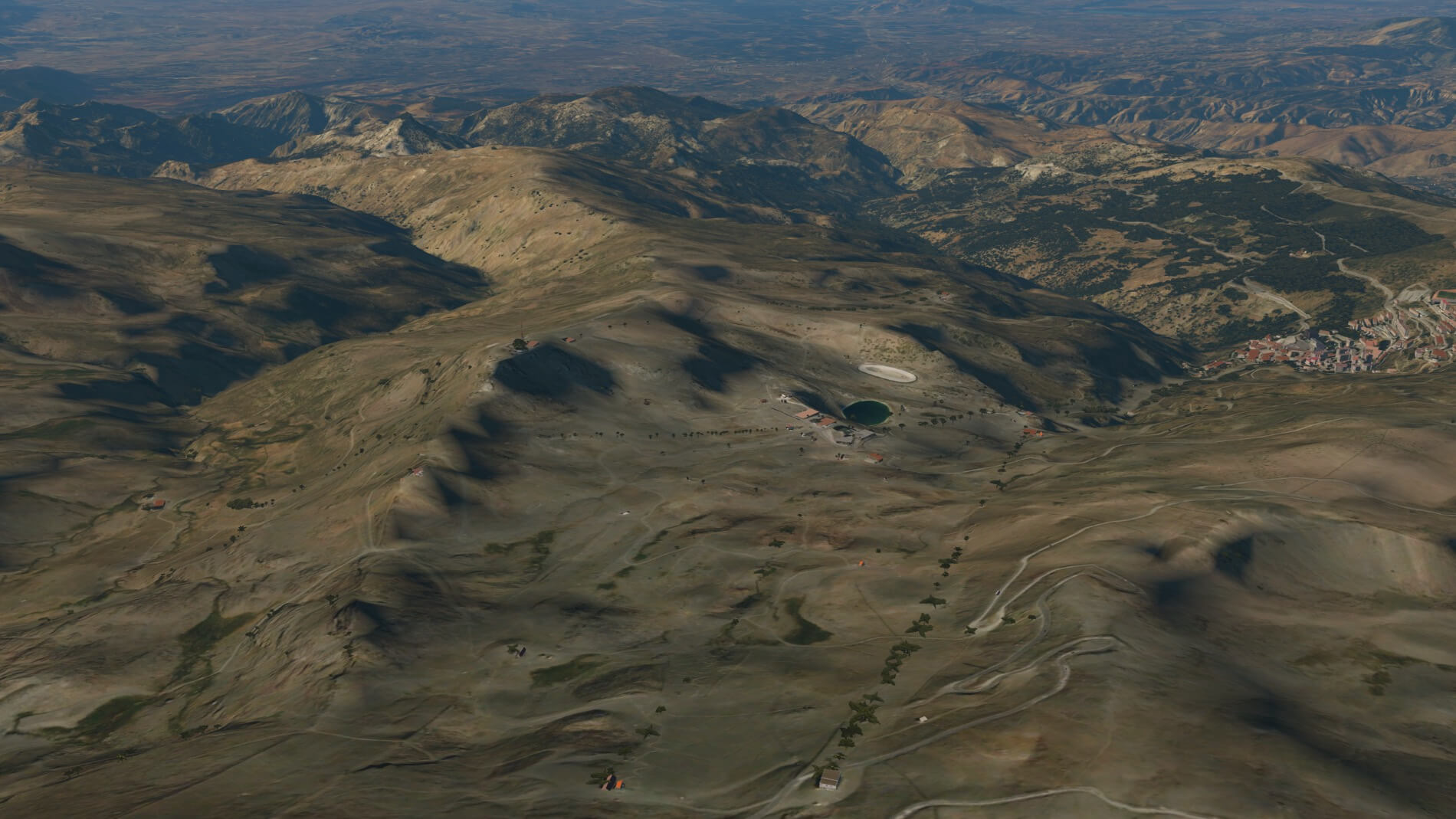
From what has been said thus far, we would expect the mountain ranges to present as fairly fantastic and with a scenic glamour that would momentarily distract the pilot from his or her pursuits. The Sierra Nevada range does not disappoint although it is not covered in snow despite its name (“mountain range covered in snow”). The peaks are well defined, the tree lines accurately depicted, and the valleys are either in sun or shadow.
The feeling of depth when flying over is quite prevalent as a result of proper shading and a well-defined mesh. Another observation that leads to the immersive experience over the mountains is an evenness of color that allows the X-Plane universe to cast appropriate shadows for the sun’s location. This is something that not all satellite imagery does well, and it does make a big difference in the presentation. The depiction of the mountains in the True Earth package are truly lifelike.
The lesser mountain ranges are true to life in fidelity and detail. For those pilots that thrill to the adventure of fighting up and drown drafts and swirling currents amongst high, jagged peaks, these mountains will be a disappointment. They are just not that kind. The peaks are lower, tend to be more rounded, and transition more gradually from the lowlands to the highlands.
Their beauty is not diminished because of this: it is simply a beauty of a different type. Don’t let their gentle appearance fool you, however. They can be vicious in their own right – especially the ones nearer the water as offshore winds fly up their windward side and create some significant updrafts and turbulence. While flying over the area the past few days using real weather, the difficult days far outweighed the easy ones, and the visibility was often poor. Two days required no-go decisions for the day.
As with any orthophoto, the effect is lessened when close up. At this point, the resolution loses focus as a result of being stretched too far since the original was never intended for close up views. There are higher resolutions that would work better but the amount of memory and processing power they would require would overpower most desktop computer’s ability to handle. Once again, we run into the age-old conundrum of appearance versus performance. One other limitation of some orthophoto constructions is they will sometimes reveal distinctive divisions between neighboring areas. Within the mountains, that is something that has not been observed thus far.


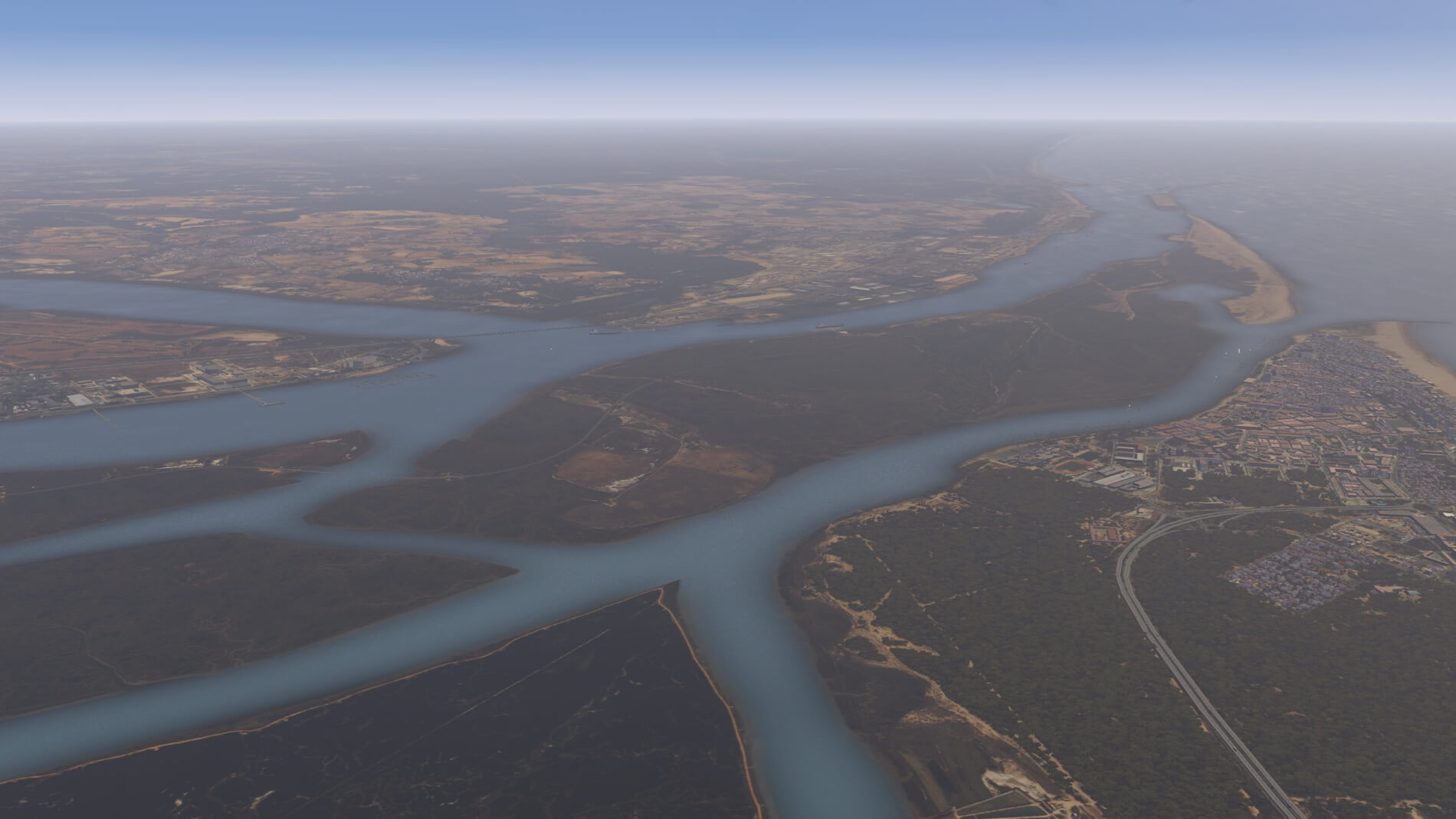
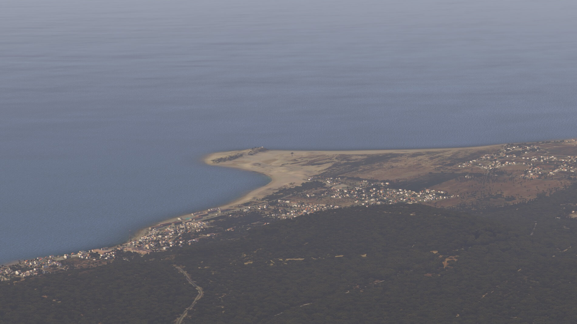
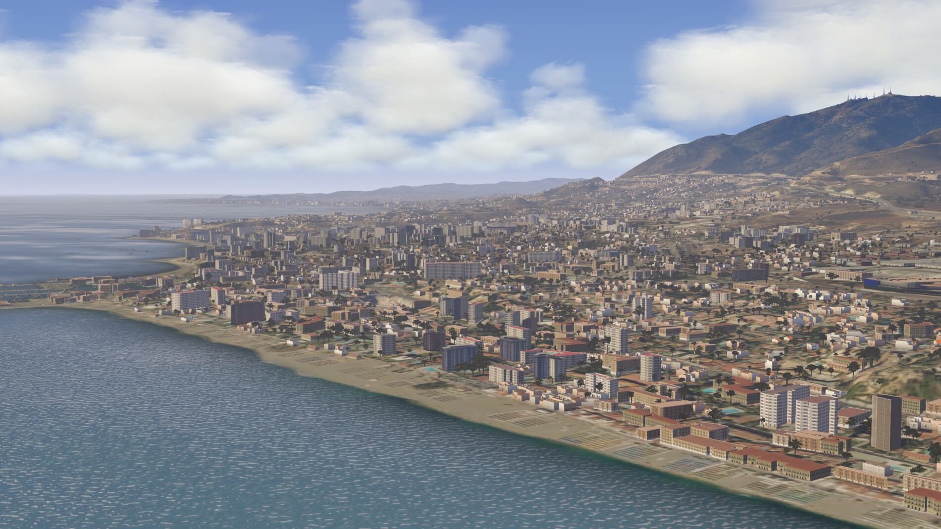
Coastlines and more Coastlines
The journey along the coastlines of southern Spain begins at Valencia and ends at Ayamonte on the mouth of the Guadiana River that serves as the border between Spain and Portugal. This stretch comprises more than half of the Spanish coast and touches upon two seas, a strait, and one ocean: the Balearic Sea between the mainland and the Spanish Balearic Islands (another Orbx package), the Alboran sea between the south coast of Spain and the northern coast of Morocco, the Strait of Gibraltar from Gibraltar to Isla de Tarifa O De Las Palomas (the southernmost point of the Iberian Peninsula and Europe) and the Atlantic Ocean from there to the Guadiana river.
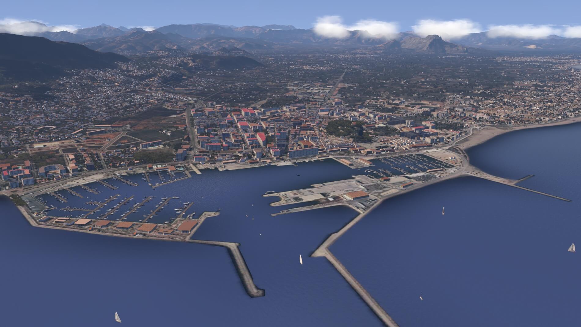
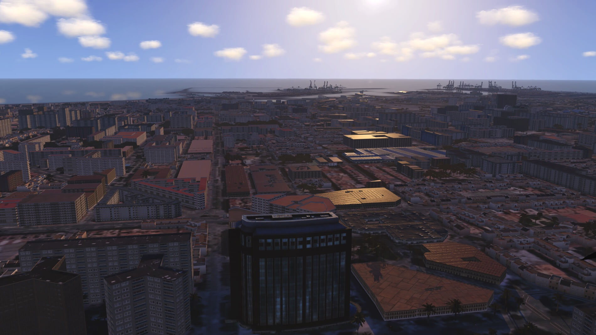
Departing Valencia and heading for the coast, the first thing that comes into view is the Valencia harbor. This is the first of fifty-five Spanish harbors or docking areas that populate the coastline covered by this scenery package. Then there is Gibraltar for a total of fifty-six. The second thing that is of notice is the blending of the shore with the ocean.
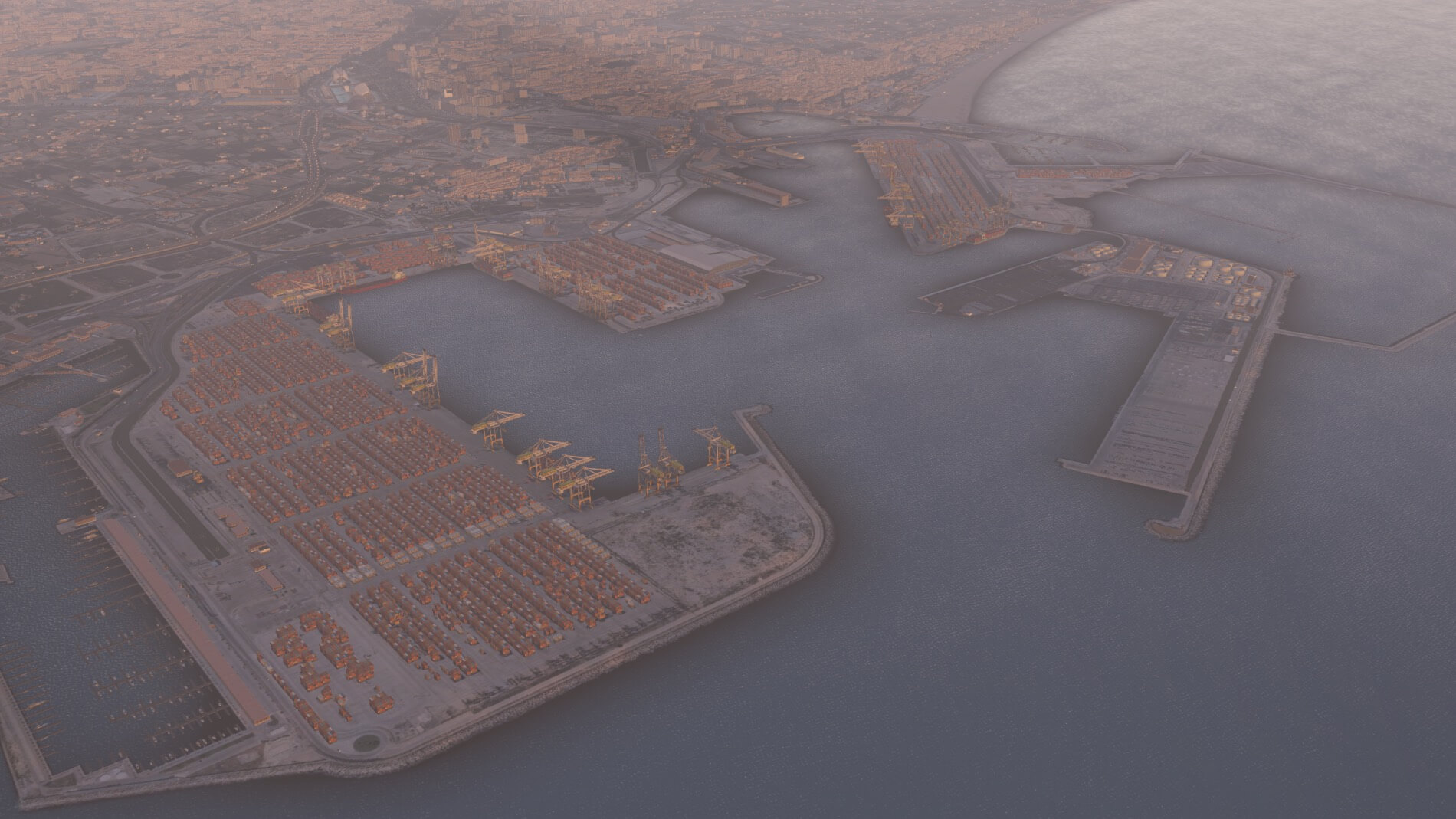
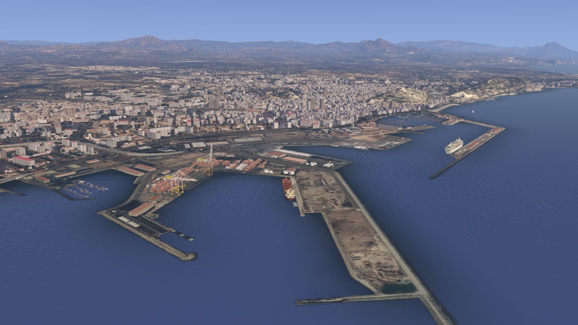

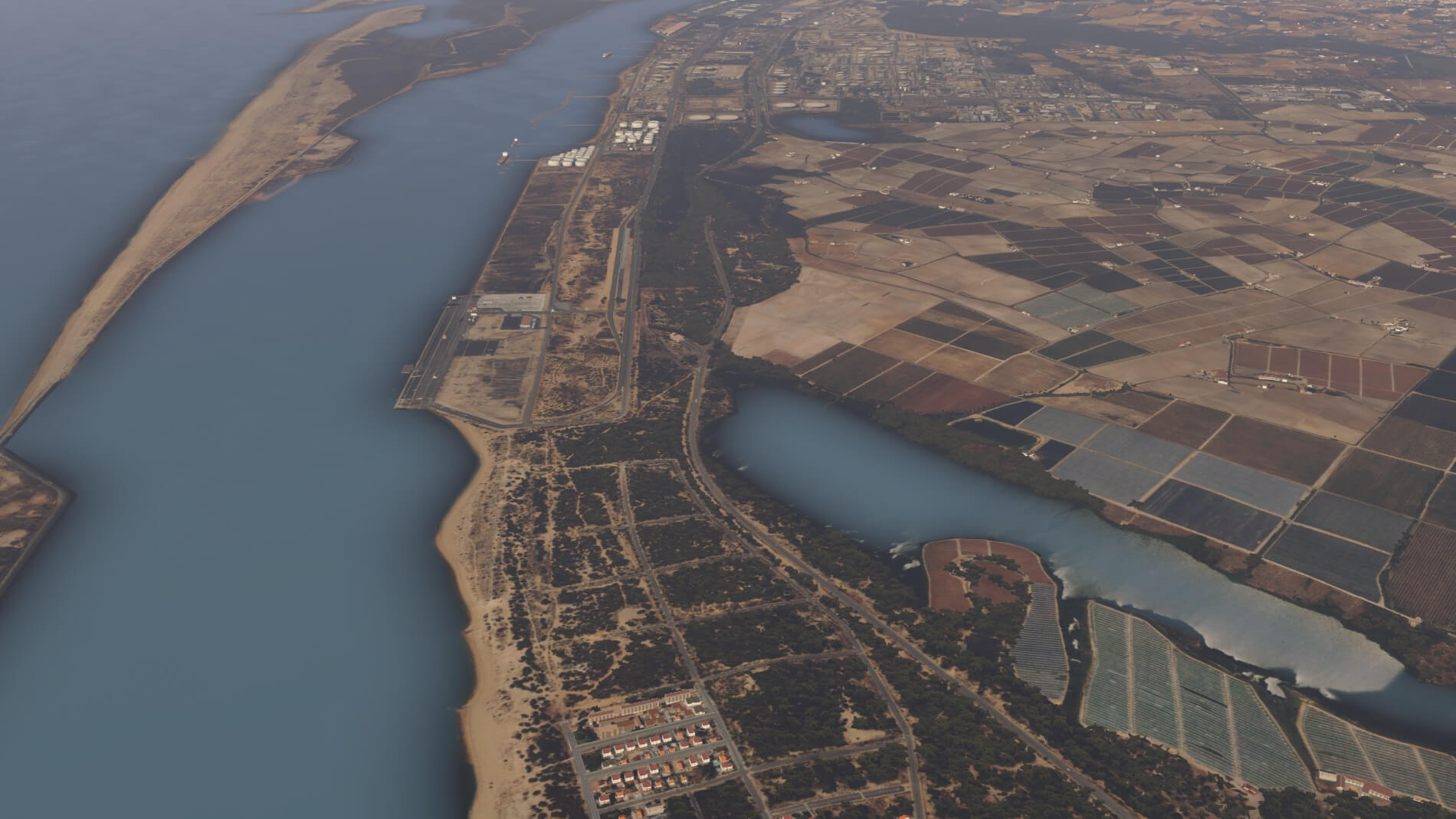


This is one of the areas where orthophoto use creates a huge difference from the default textures. It is even more pronounced along inland bodies of water. Two non-ortho default texture replacements (personally used by the author) come no closer than the default textures when it comes to rendering shore lines.
As previously mentioned, the custom mesh creates a huge improvement in the impact of the coast lines. Rocky crevices and formations appear as they should with detailed crenulations. Outcroppings and river deltas are clearly defined, and small offshore landforms appear as they should.


Anomalies
A project the size of a True Earth project is never going to be perfect first time out the door and the user is bound to spot things that got missed during production and preparation. Many hours have been spent flying over this area while analyzing and looking for things that may not totally meet the purchaser’s expectations. In this case, color is the problem.
While Spain seems to have frequent landscape changes in small areas, those color changes are consistent with a change in texture and the colors follow the boundaries, From the Alicante area on the east coast around through to Málaga on the south coast, the color cast crosses natural boundaries. These color shifts have not been observed in the western sections of southern Spain.
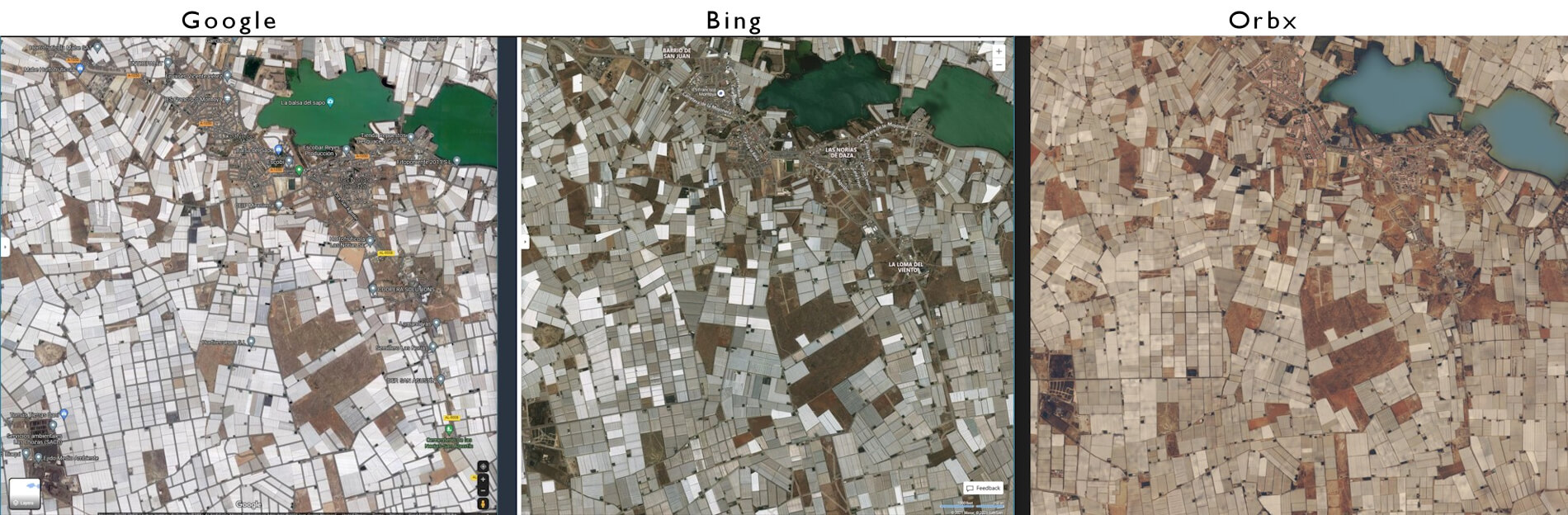
Observations from Google Earth, Google maps, and Bing maps shows that there are some serious issues inherent in the satellite photography of this area. While it is apparent that Orbx has tackled this problem and attempted to smooth out these issues, some residual problems remain. The area around Alicante displays a noticeable colorcast of a brown hue while the area south and west displays a distinctive green tint. The degree that this is noticeable depends somewhat on the time of day and angle of light.


The tint might not seem obvious until your flight takes you over the boundary and you have something to compare it to. This is unfortunate in that one of the major reasons for obtaining an Orbx True Earth package is to not have these distinctive areas that are present in do-it-yourself orthophotos. The fortunate part of this is that it does not affect a major portion of the scenery. There are several options available for adjusting the native shading and coloring of the X-Plane world that, when used, can help minimize this even further. The hope is, of course, that Orbx will revisit this project and release an update at some point that will correct this.
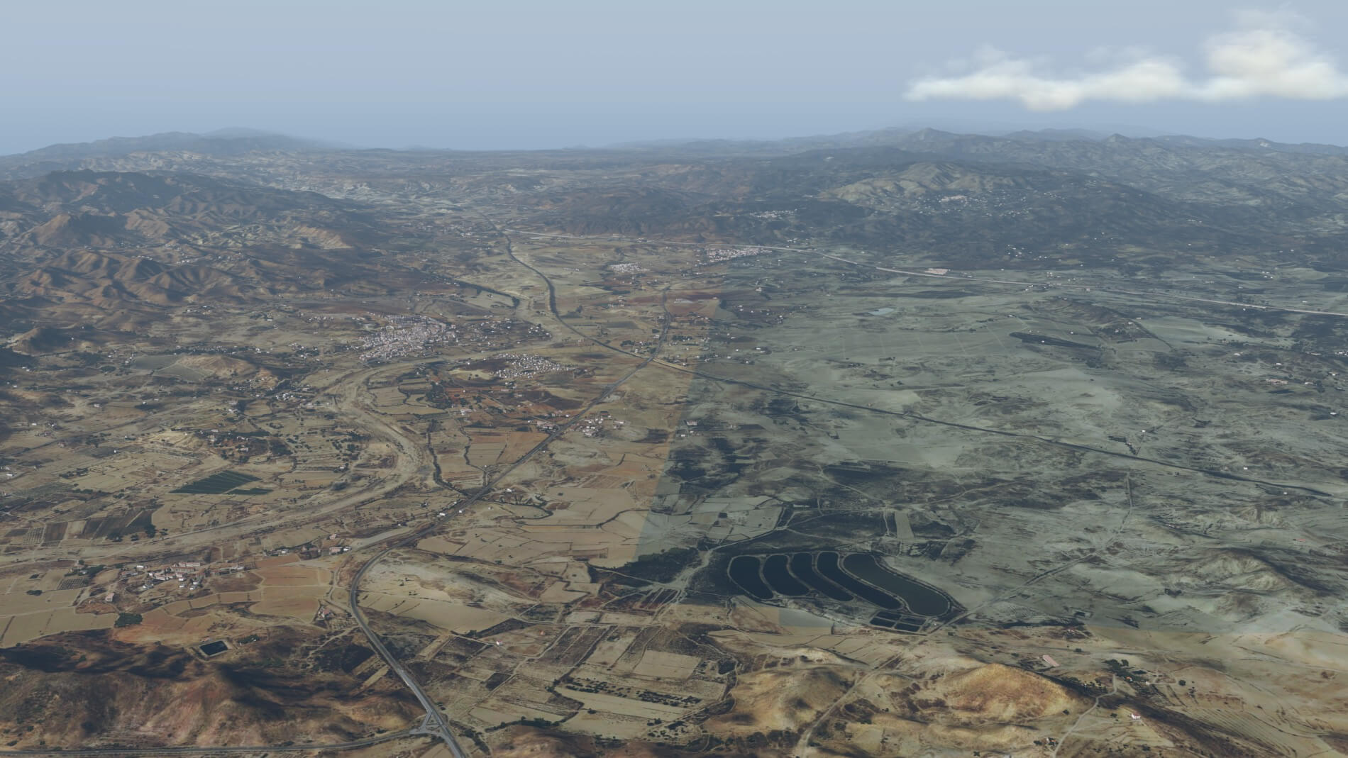
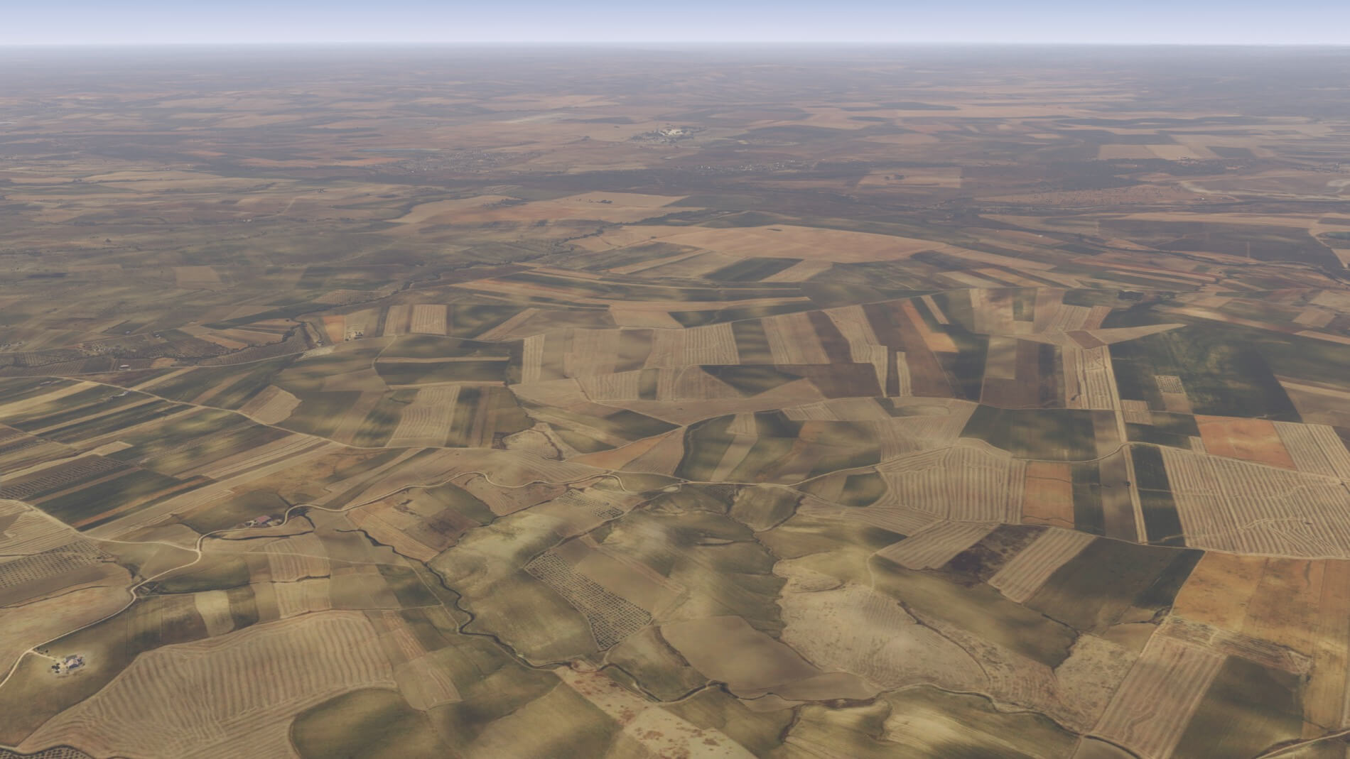
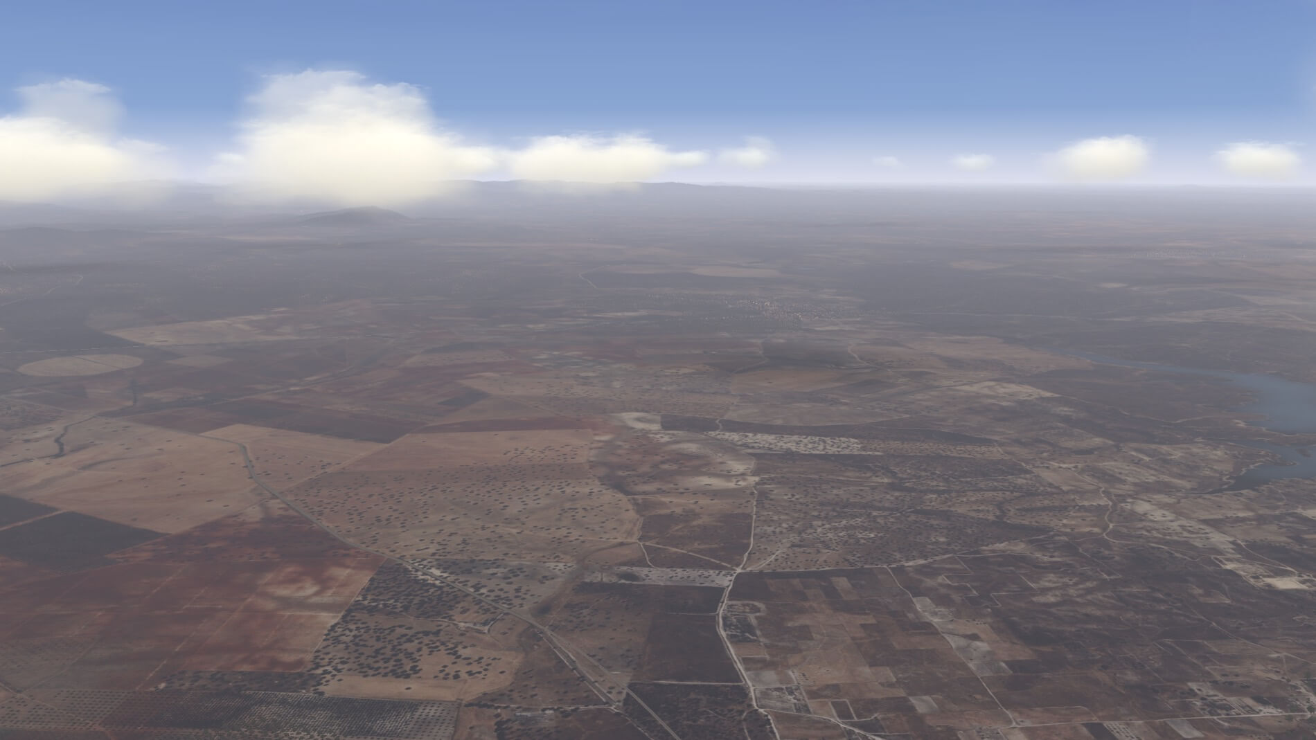
The Remaining Terrain
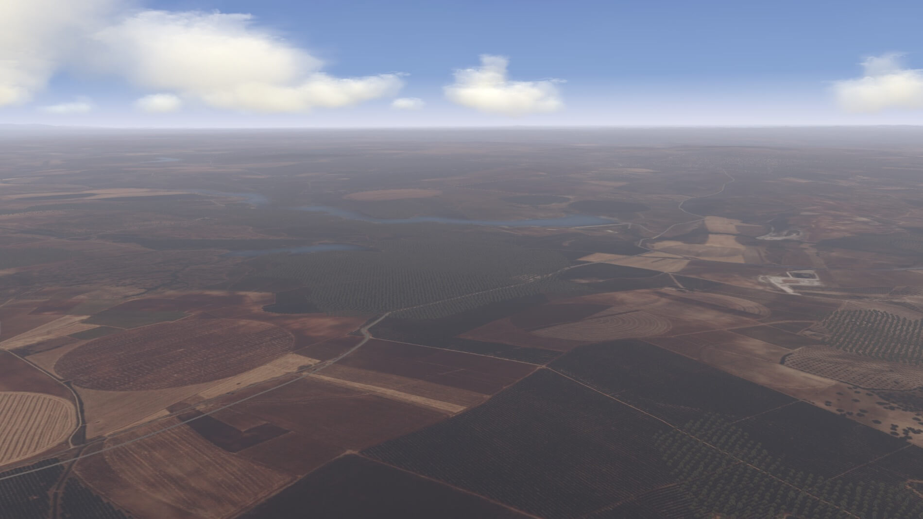
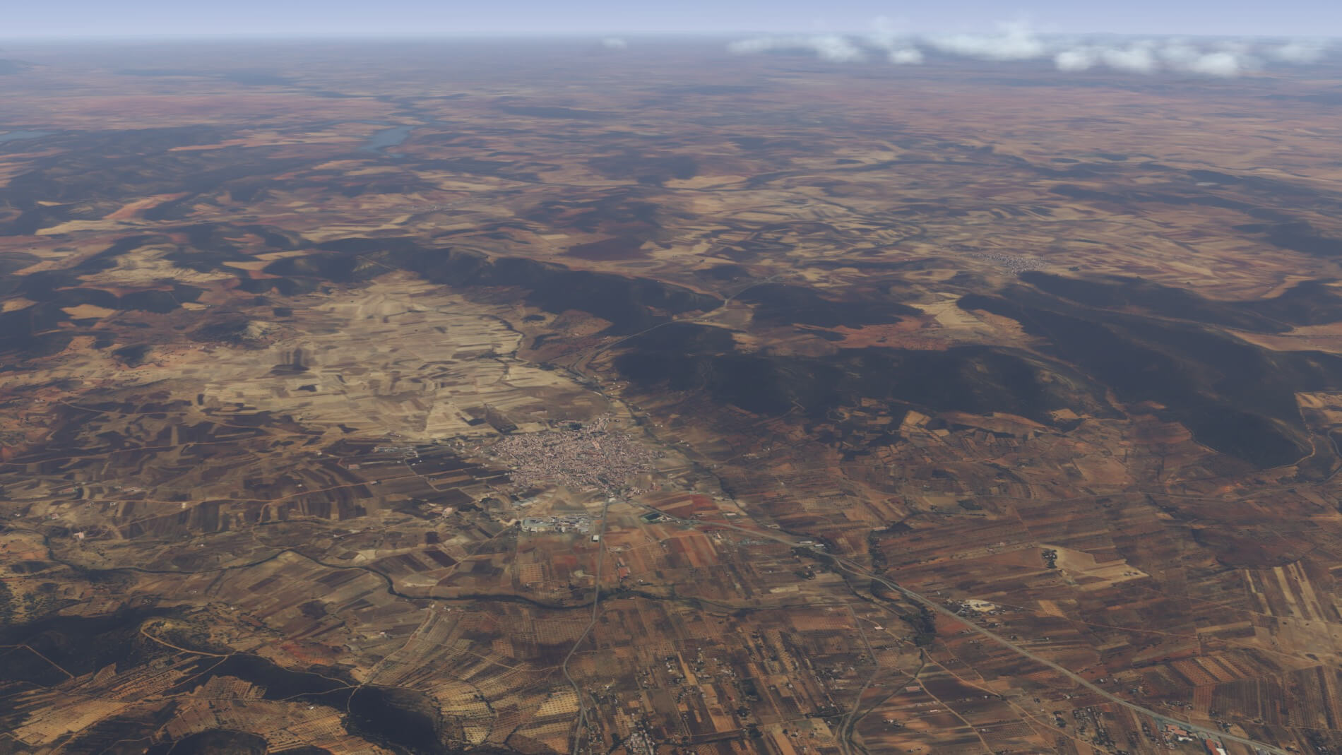
West of the Sierra Nevada mountains beyond the steppes of Granada lies the southern part of the Meseta Central with Toledo as the only significant population area. From there is the Guadalquivir River and basin and La Mancha. From the air, this does not seem quite as dramatic as the mountains and coastlines, but it does present a patchwork quilt of terrain colors and textures that stretch on for miles.
Olive groves, fertile fields, dry arid stretches of sand all surround Seville – the jewel in the crown of Orbx’s True Earth EU Southern Spain. Before we get to the cities, let’s look at the last of the natural features – and maybe a couple not-so-natural ones while we’re at it.
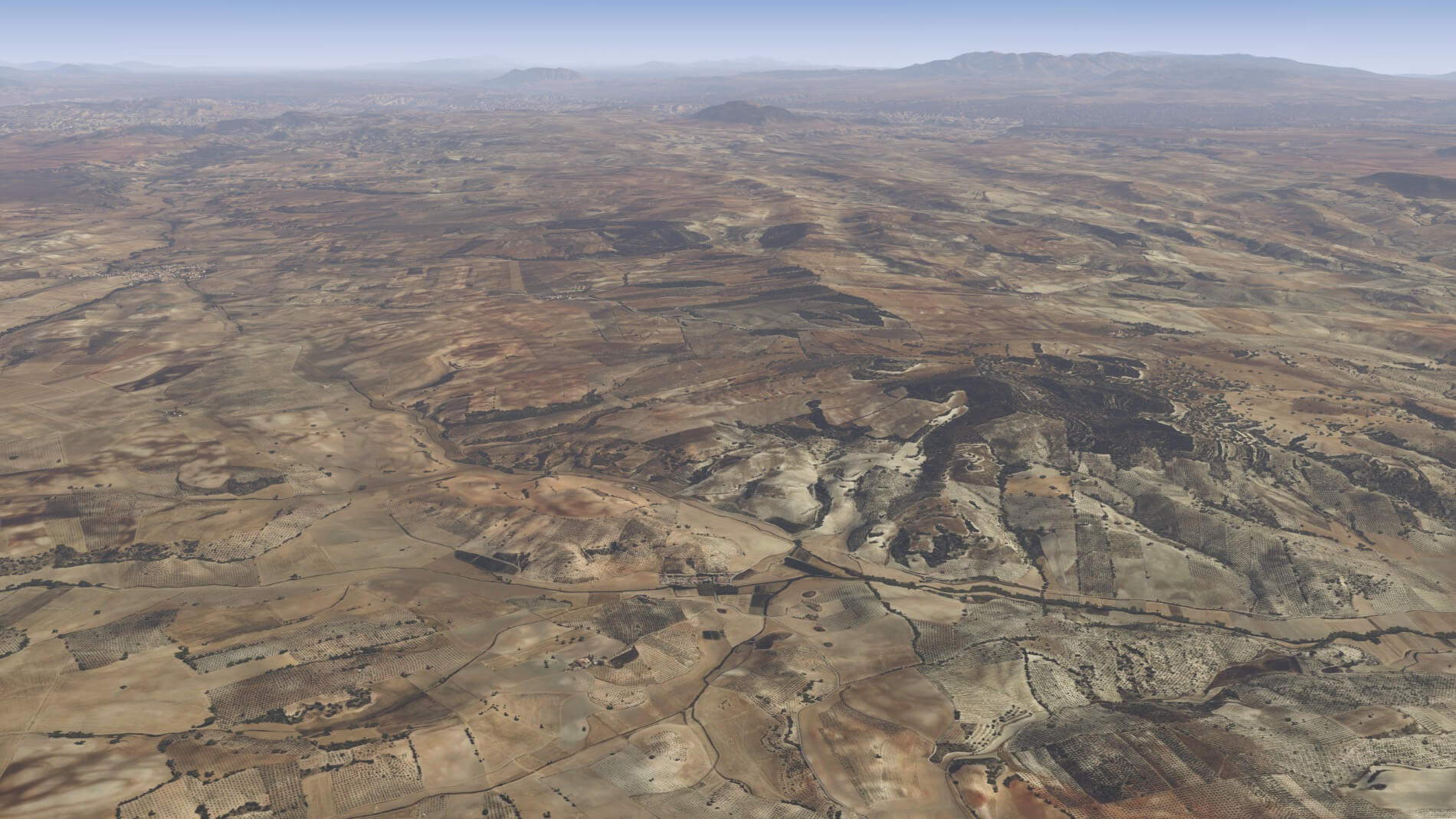


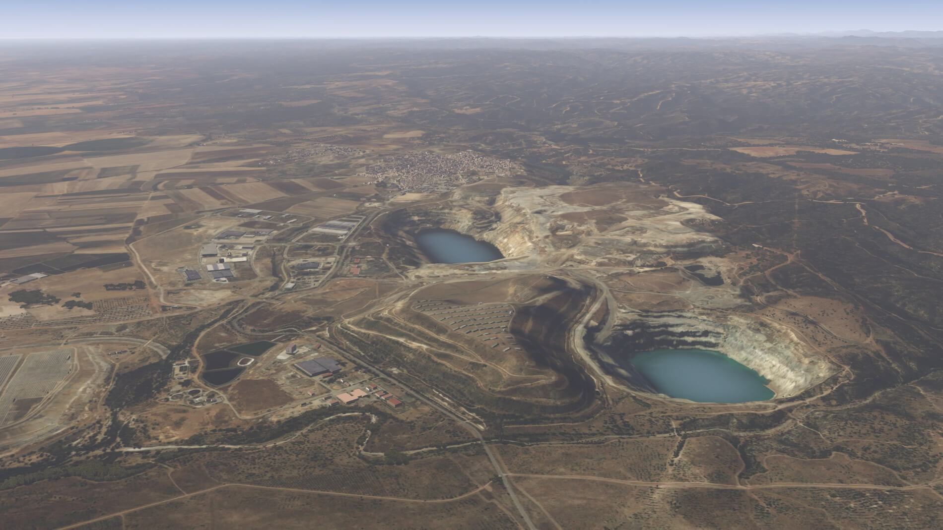

Orbx’s work on the orthophotos gets to end on a high note out here west of Seville. The colors are spot on, and the gradations are smooth with the patchwork of the open areas well defined. The mesh work is very well done with the rolling ground, the shores of the inland bodies of water, and the holes in the ground created by the open mines. The terrain changes nicely and appropriately based on time of day and weather conditions. Add this to the mountains and coastlines and this is what True Earth is all about.
True Earth Overlay: Architecture, Autogen, and Trees
Orbx’s work on the overlays really separates a True Earth project from other solutions to terrain modifications. Orbx advertises a Spanish-themed autogen, points of interest, and accurately placed trees.
Before moving into a discussion about this part of the project, two items are worth mentioning. One is helpful to the scenery and the other is an issue that needs to be clarified before we look at the autogen in more detail.
Firstly, the helpful item is a reminder of the available option to disable the default X-Plane roads. What this does is leave a transparent roadway in place so ground traffic will still move through the scenery, but the aerial photos of the roadways will show rather than the heavy dark lines of X-Plane roads. This can be particularly useful in urban areas, where roads pile up on each other in a catastrophic manner in tight intersections and other road formations such as traffic circles, interchanges, and the like. This is a matter of personal choice, but if you want to activate the feature, please refer to the installation section at the beginning of this review for how to do that. Screen captures in this section are done with that option selected.
The second issue to be addressed has to do with who does what and when. When a developer sets out to create an addition to the default X-Plane world, they will need to contend with that default world. The world of X-Plane follows some specific rules when it comes to how the various layers of that world interact. This is the reason that placing things in the wrong order in the scenery_packs.ini file can result in many problems. This is also the reason one of the first things a developer will do for troubleshooting is to ask to see that file.
The developer needs to respect the rules of the X-Plane world if they want their project to be successful. This becomes incredibly important for any project that uses a custom mesh or a custom overlay of objects such as Orbx’s True Earth autogen buildings. The problem that has emerged in True Earth EU Spain South is a very frequent occurrence of their autogen encroaching on default airports and co-locating default buildings with autogen.
Obviously, one building sticking out of another, especially in an area where the pilot is going to be seeing the scenery up close, can be disastrous for a project like this one. The issue has not occurred as frequently in other True Earth packages because the default airports in those areas more frequently adhere to the rules. In Spain South, a significant number of airports have not done so thereby making the problem more visible and therefore, more relevant to the user. It also increases the number of complaints Orbx will receive about their project.
The problem lies, however, with the default airports and not the True Earth package. This reviewer worked with the developers to investigate the nature of the problem and they confirmed that this is the case. The resolution will need to be addressed by Laminar Research and not Orbx. All the airports included in X-Plane, or available from the scenery gateway, in this area need to be reviewed to correct the places where those airports do not follow the rules that apply to scenery in the X-Plane world.
Were Orbx to correct them and bundle them in with the True Earth package, those airports would not receive any updates to the default airports that could happen with subsequent X-Plane releases. So, as we move forward with an examination of the architecture that Orbx has provided in the overlay they created for southern Spain, we will be ignoring any areas where the autogen is encroaching on an airport.
Autogen
So, this term autogen has occurred frequently in this discussion about the Orbx project. If you are at all like I was when I first encountered X-Plane, you are scratching your head and wondering what the heck this is. Autogen is a shortened term for automatic generation. This refers to pretty much every building and bit of vegetation that occurs in the X-Plane universe.
Based on a set of rules, a selection of models is scattered automatically about the world we fly in. What is not autogen is individual models of particular items that are individually created and their placement in the world is a specific location defined by the creator of that object. True Earth Southern Spain has both. Orbx refers to the individually created models as points of interest.
Our next task is to look closely at the autogen and see if it contributes any value to the scenery package. The autogen is important because there is much more of it then points of interest items and the appearance and style and make or break the immersion factor.
Red, orange, and pink roofs. Sun-washed whites, beiges, light browns, and tans. These are the predominant colors of the buildings seen in an aerial view of any of the urban centers when seen on satellite views. These same colors are prevalent in autogen created by Orbx whether in a densely populated area or out in the countryside scattered amongst the hills.
Within the cities, tall buildings and other industrial or commercial buildings mix in with residential housing. Some of the buildings have an old-world appearance while others are contemporary. Building placement is mostly accurate with some of the buildings taking on odd shapes. The placement, size, and shape of the structures is determined by the LiDar data as mentioned earlier. This seems to be mostly successful with only an occasional tall building appearing out of place in the middle of country areas.
This is not unique to this Orbx project and can be observed in the default X-Plane autogen. One other issue that is inherent with autogen is the way it does not always behave well in situations where the mesh creates sudden changes in elevation or in areas where those changes occur very close to each other. As this characteristic is germane to this part of the X-Plane universe, it cannot be considered a detraction to the Orbx project.


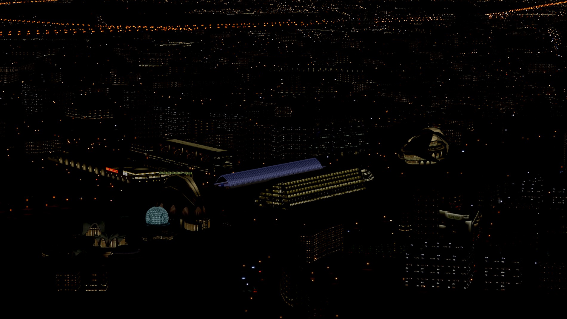
The textures of the autogen are sufficiently detailed to maintain a distinctive appearance from a distance. They are not extremely detailed which is probably due to a need to not overwhelm systems and destroy frame rates. The buildings properly reflect the lighting conditions as well as provide light at night.
Lastly, the autogen blends well with the points of interest that Orbx has individually modelled. There is enough difference in the quality of textures and shading that the crafted models stand out to a degree and remain noticeable from the air which certainly helps when trying to find them.
Here is a parting photo that shoes how the accurately spanish-themed autogen adds to the landscape from 20,000 feet.
Vegetation
Vegetation placed on terrain where photos of trees are included do enhance the area quite well. Rarely is vegetation a distraction and that is how it should be. It should not stand out either because it is so obvious you can’t help but be distracted by it, or it is so poorly done that it ruins the immersion created by the aerial view of the terrain. Additionally, it is critical that vegetation seen up close around airports is well modeled and placed.
Palm trees in the middle of a northern territory work no better than scrub pine in a rain forest. These are noticeable when they happen and even worse when they happen near an airport. Thus far, trees and vegetation seem quite happy to play a supporting role in the Orbx world by being what they are supposed to be and where they are supposed to be. Vegetation around the airports that were visited appeared sharp and clear and of the right type. Overall, the variety and height of vegetation appears to live up to the Orbx claim..
City Stories: The Architecture of Orbx
Or also called points of interest.
Our last piece of business in southern Spain is the points of interest. According to Orbx, the scenery includes “over 200 POIs covering major cities, castles, churches, and key landmarks.” This translates to a visual paradise for the VFR pilotage flyer. Likely, most of these are contained within city limits but that does not rule out the possibility that Orbx has dropped one or two out in the wilderness somewhere. Part of the fun with a package like this is spending hours flying over the vast area while trying to find all of them. This low and slow pilot has come across a few in the outer limits but will remain within city limits and let you have the joy of discovery.
Orbx specifically highlights the Costa-Del-Sol and the cities of Málaga and Granada. Our survey of features will begin there and then move on to the unique architecture of the City of Arts and Science in Valencia. Our city survey will conclude with what may well be considered the penultimate city, in the Orbx package, of Seville.
Costa-Del-Sol
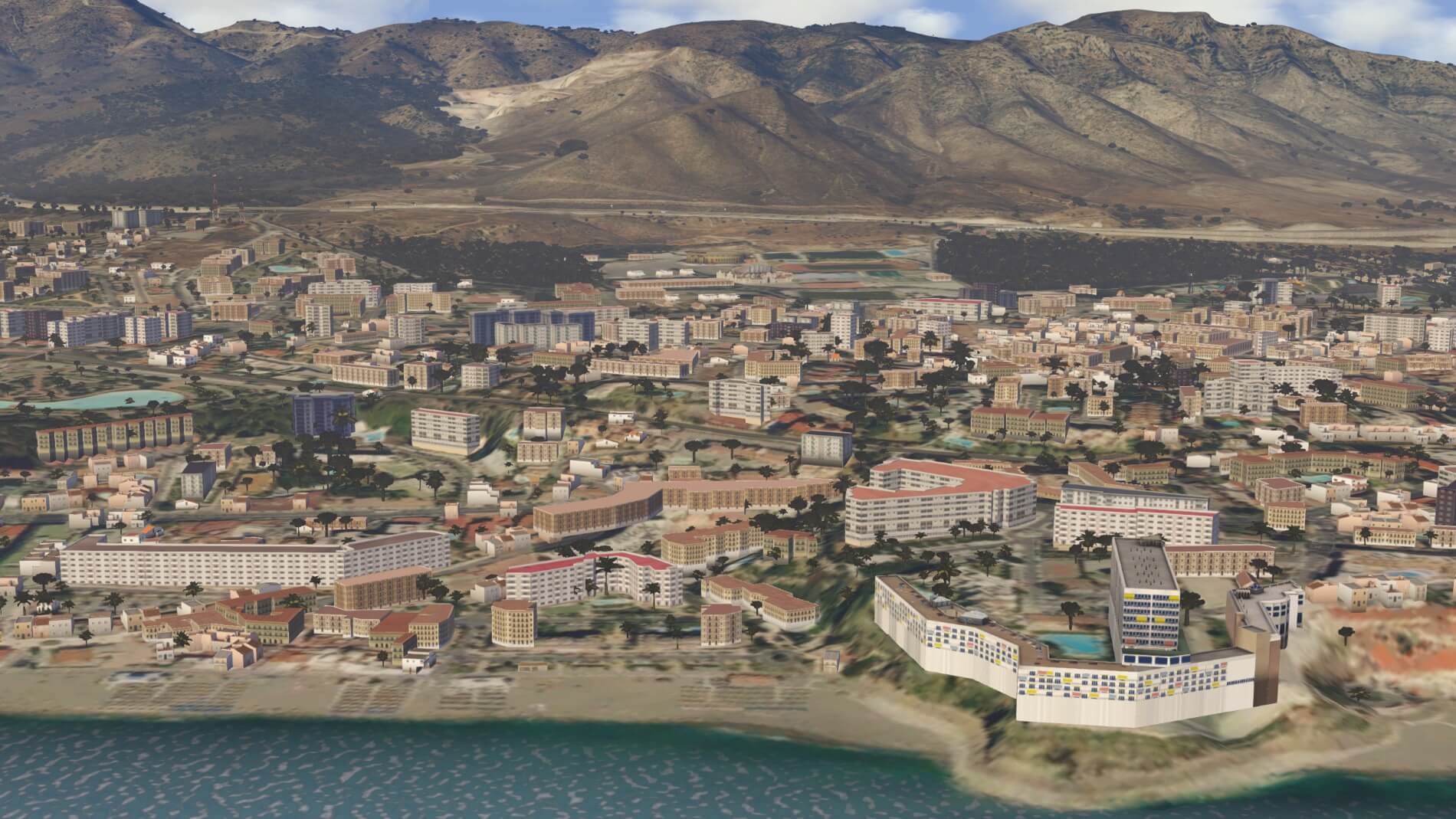
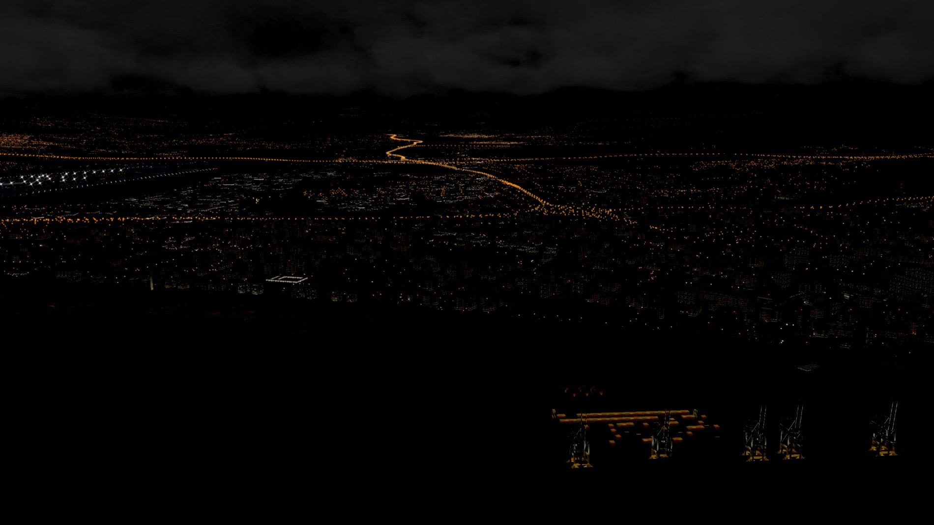
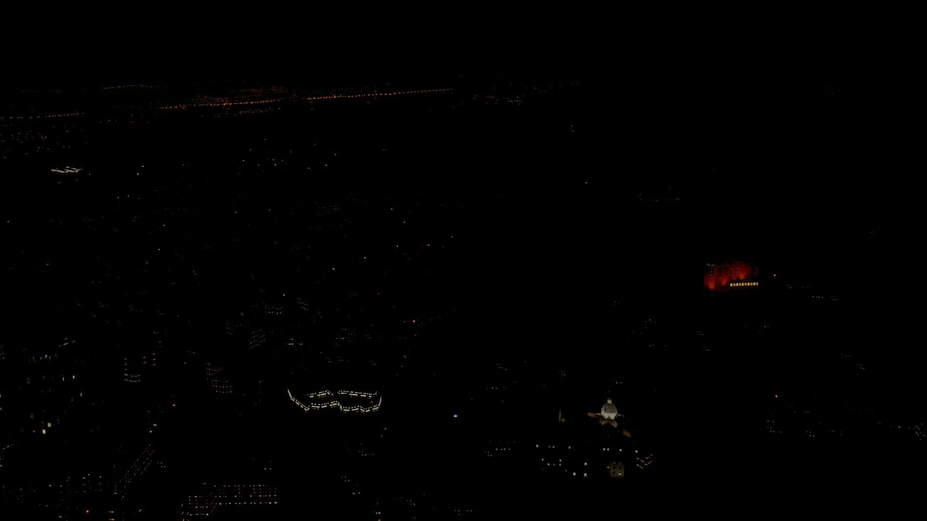
Costa-del-Sol is a fifty mile stretch of nearly continuous beach running along the Alboran Sea beginning just to the east of Málaga and ending at Punta Chalera. This area in the Orbx world consists of some unique autogen buildings and several points of interest. Finding the points of interest is tantamount to looking for a nut in the engine compartment of a jet. One trick to finding some of them is to “turn off the lights” (otherwise known as fly at night)!
As with all the points of interest that were discovered during this review, the ones at Costa-del-Sol do stand out because of the increased attention to detail afforded them. It is important to note not all the points of interest are buildings. The increased level of shading for more defined shadows and a sense of greater depth perception, along with a higher level of detail, helps these items be more conspicuous than there autogen neighbors. This is one area for a low and slow flight.

Málaga
Málaga is a municipality, capital of the Province of Málaga, in the Autonomous Community of Andalusia, Spain. With a population of 571,026 in 2018, it is the second-most populous city of Andalusia and the sixth-largest in Spain.
Málaga contains several points of interest for your enjoyment. Some of them are easily spotted on the eastern shoreline. A little disappointment here, as well as in a few other places, is the elevation problem mentioned in the discussion about the autogen. One would expect that, with so much time spent creating the model, the developers would take the time to assure an accurate placement for it.
This may be a bit of a quibble since the issue is not highly visible from the air, but it is sufficient enough to show up during a low helicopter buzz over the area or when fans of 3D artwork “take a walk” on the city streets for a close-up view of the model. Perhaps a future update will resolve this.
At Málaga, as everywhere else, you can always turn out the lights to help in your search.
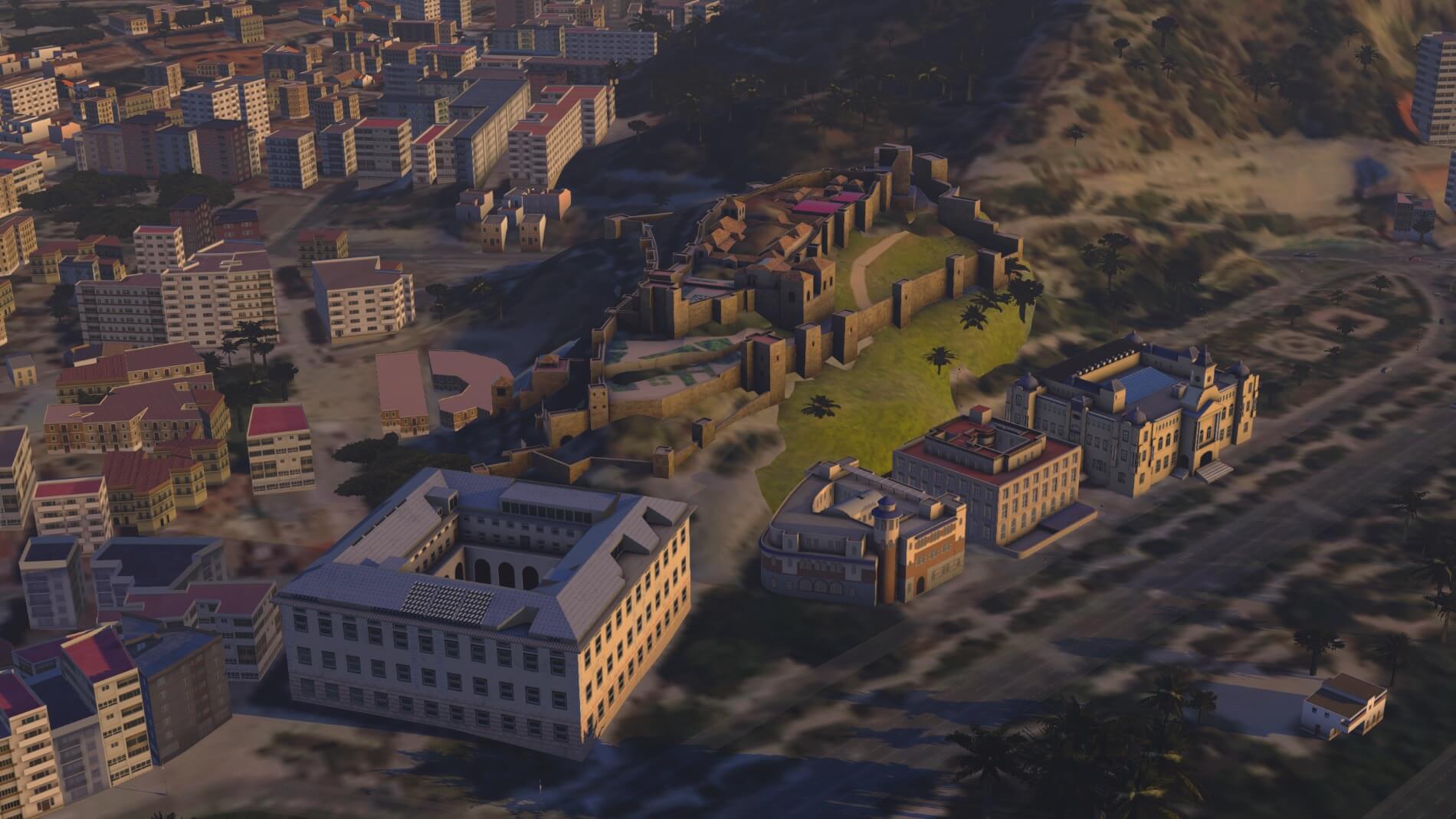

Granada
The greatest artistic wealth of Granada is its Spanish-Islamic art – in particular, the compound of the Alhambra and the Generalife. The Generalife is a pleasure palace with attached romantic gardens, remarkable both for its location and layout, as well as for the diversity of its flowers, plants and fountains.
Now we enter the city on the steppes that was the last stronghold of the Moors in Spain. It fell to Ferdinand II and Isabella I in January of 1492. How many of the historic wonders did Orbx include in Granada? It could take some time to find out. I had flown over the city four times looking for them and I missed some until I “turned out the lights” and I still don’t think I’ve got them all.
Referring to an earlier section for a moment, you can see in these photos how well the autogen is working. If you think you see some default X-Plane autogen in Granada, you do. Orbx has done a nice job using some of the commercial autogen to blend in with their spanish buildings to give it a twenty-first century appearance.


It is obvious that Orbx has put a lot of effort into the three areas they highlighted in their description of the scenery package. Does that same effort hold in other areas? Let’s begin a search.
Toledo
Toledo is considered (Brittanica Toledo) most representative of Spanish culture, and its historic centre was designated a UNESCO World Heritage site in 1986.
A brief fly-over of Toledo reveals the Museo del Ejército in full prominence and that is about all there is to see here other than a nice combination of autogen complementing the structure and conveying a sense of the history that is embodied in the city.
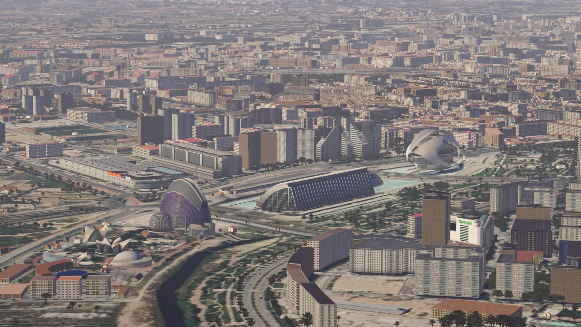
Valencia
Never afraid to innovate, Valencia diverted its flood-prone river to the outskirts and converted the former riverbed into a glorious green ribbon of park winding right through the city. See Valencia Travel Lonely Planet.
Valencia is the capital city of the Valencia provincia as well as the autonomous community of the same name. “The city of the 100 bell towers” has many more points of interest on display than what can be shown here. Simply stated, the helicopter pilots can have a good amount of fun, and spend a lot of time, flying a pattern over the city to find them all.
Given its prevalence in the city, and throughout Europe, a capture of the City of Arts and Science is a requirement.
Seville
Capital of the provincia (province) of Sevilla (see Britannica Seville), in the Andalusia comunidad autónoma (autonomous community) of southern Spain… An inland port, it is the chief city of Andalusia and the fourth largest in Spain.
Seville is also the hottest city in Spain with summer temperatures reaching over 45°C. This can certainly affect your plans to fly out of Seville airport! Assuming you do get off the ground, there is much of Orbx’s work to see in the city. While it may not be true, it seems like half the points of interest were created for Seville by the time you finish taking them all in.
Additionally, a few close-ups will continue to show how Orbx has dedicated themselves to creating visually stimulating points of interest for both day and night flights.

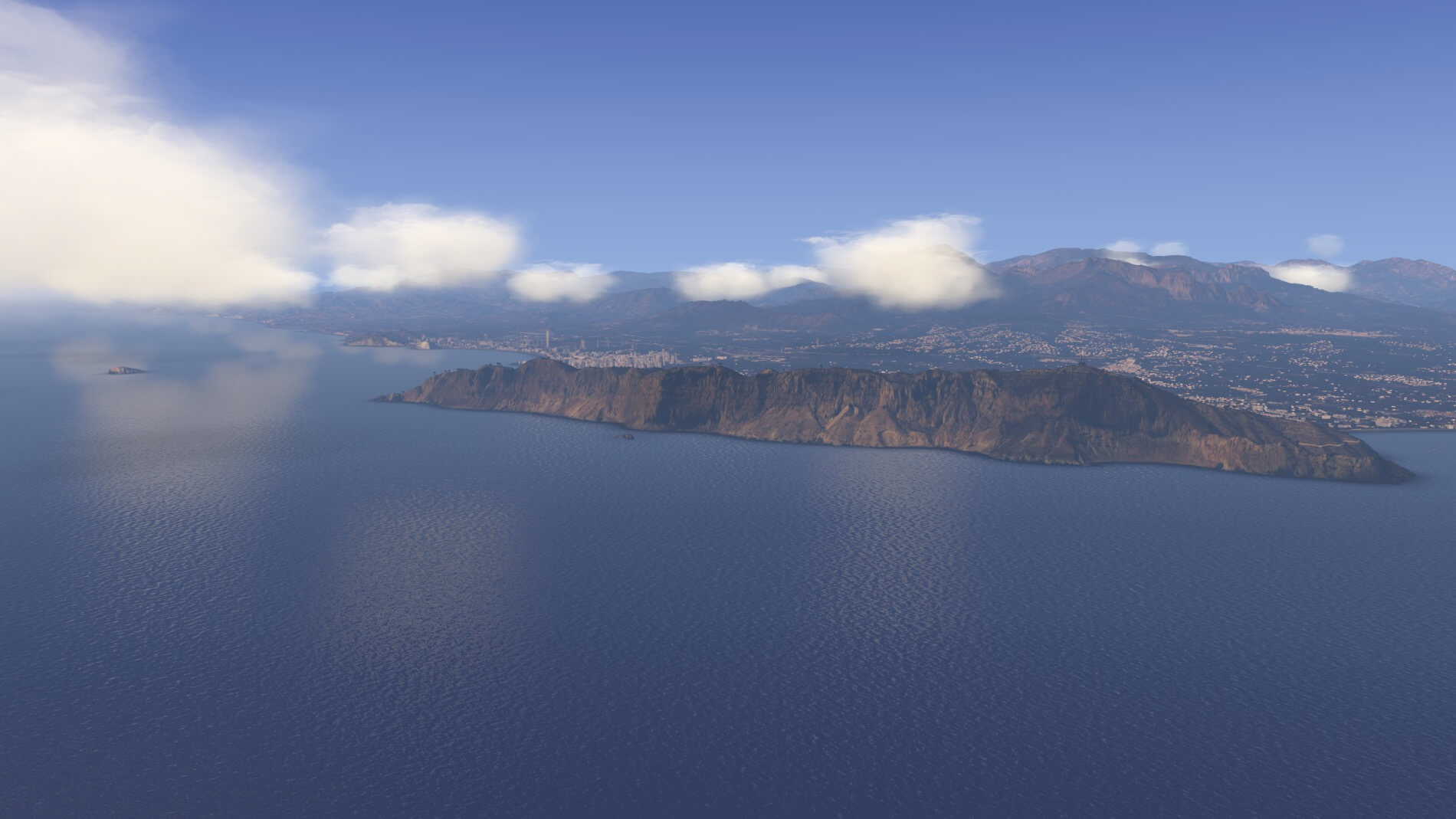
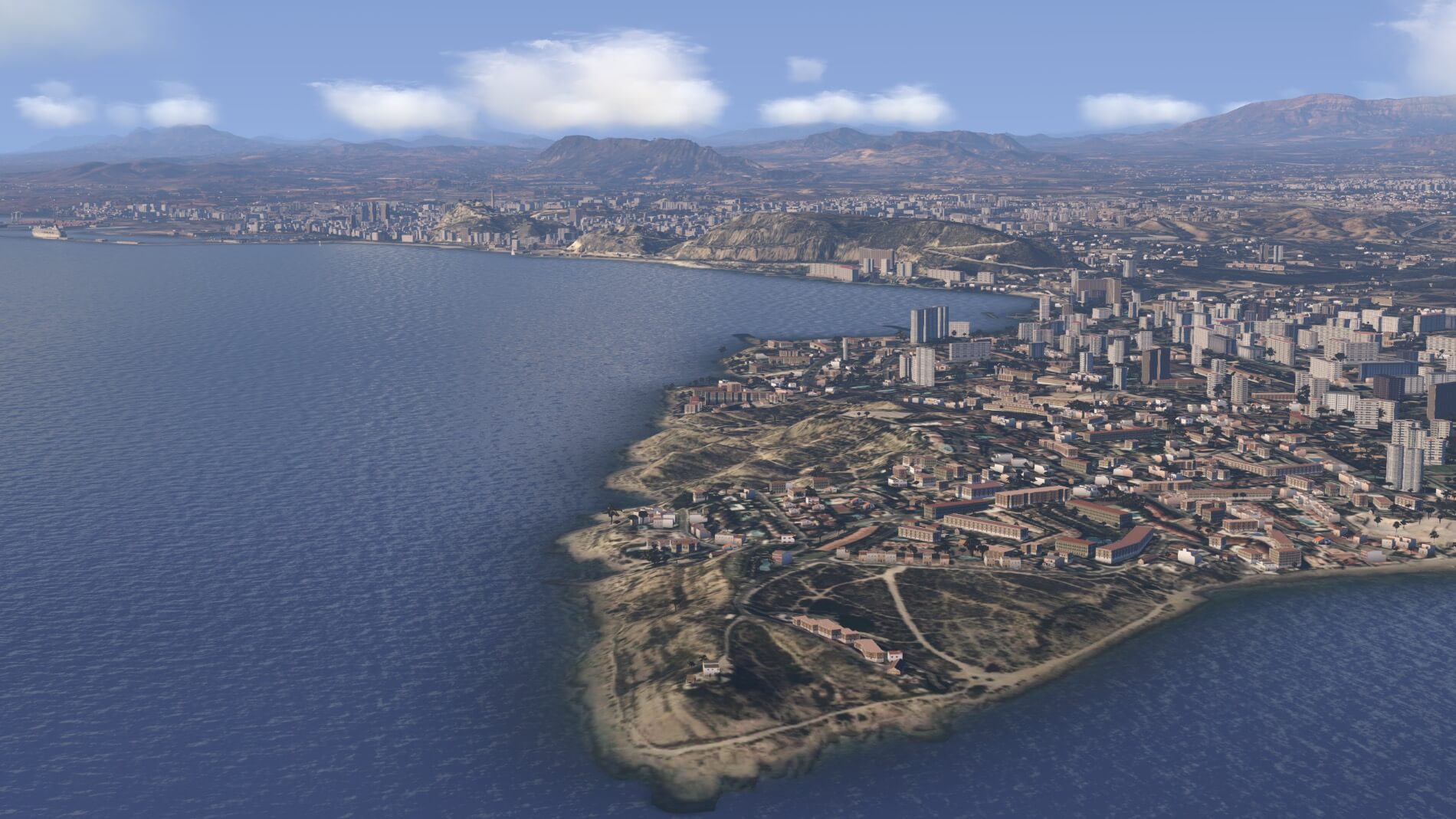
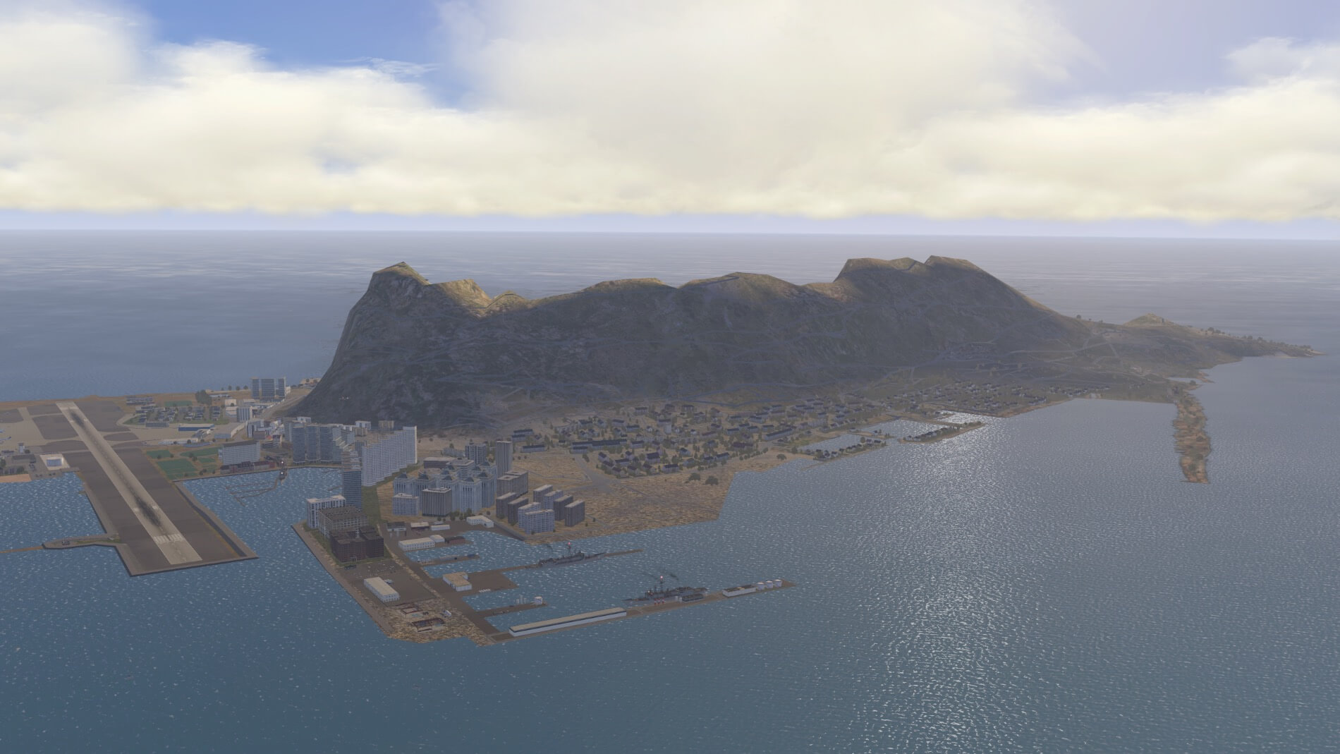
Gibraltar – Iberian Peninsula
Gibraltar is a British overseas territory at the southern tip of the Iberian peninsula and has around 30,000 residents. It’s has also been a British territory since 1713, though Spain continues to claim sovereignty over the territory
The inclusion of Gibraltar in the scenery is a commendable decision by the developers. The rock is so close to the coast of Andalusia that the default textures visible while flying over the ortho scenery of Spain would certainly put a damper on any sense of immersion. Rather than choosing to skip the overlay objects on the peninsula as they did on the overflow ortho scenery that covers a small bit of Portugal, they not only included their autogen but added several custom models as well.
Gibraltar is home to one of the more extreme airports in the world. Flying in and out of it represent challenges both natural and created. The winds around the airport can make for interesting challenges when trying to land. A bad decision could see the pilot and his or her aircraft finding their way into the water at either end.
The created feature that makes Gibraltar airport unique is the road that crosses the runway. Winston Churchill Avenue is guarded by movable barricades that close when aircraft land or take off. The Government of Gibraltar has one failed attempt and is working on a new plan to relocate the traffic from the Spanish border to another by-way.
Another challenge that may or may not find its way into the simulator through flight planning tools is the political atmosphere between the U.K., Spain, and now the EU over who owns the airport. This discussion appears to be affecting authorized flight paths between Gibraltar and Spain’s airports. Currently, the predominant use of Gibraltar is for travel between the peninsula and the U.K.


The one drawback to this part of the scenery results from how close the runway is to the Rock. Using the airport forces the virtual pilot right up against it and the limits of orhophoto are soon extremely evident. When compared to the default, it seems a reasonable argument to support blurry orthophotos over default textures. At least in some cases.
And so, here ends our journey over 98,000 square miles of the Iberian Peninsula.
“Is it Worth It?”
Ultimately, that question is what it is all about. The answer to that question will always be an opinion no matter how it is looked at. Some opinions may be more informed than others and, since it is your money on the table, you would probably like your opinion to be one of them. Hopefully this comprehensive review of the good, fair, and not-so-good aspects of True Earth EU Spain South has been helpful in providing accurate information to help you reach your own informed conclusions.
On a personal note, I have found the Orbx True Earth series takes me beyond the boundaries of flight. While I enjoy the orthophoto enhancement to the default scenery, I particularly enjoy the points of interest that are a feature of the series. It is a bit of a flight adventure to find them but then, once found, the curiosity about why a particular thing is modeled has led me to look up what it is and why it was selected for inclusion.
As a result, I know a few more bits and pieces about the world I live in then before I flew over an Orbx TE scenery. I will readily admit this review took a rather prodigious amount of time for that very reason.
So, does this package go into the recommended for your simulator column? This reviewer’s opinion is yes, it certainly does. The scope of the project is immense. It seems entirely reasonable to expect that it is not going to be perfect. Then again, what is? It seems, in the world of computer programming, that the bigger something becomes the more likely flaws will manifest.
The areas that would benefit from an update are far outweighed by the amount of the project that can stand on its own just the way it is. Orbx has a long history of transforming terrain in the flight simulator world and their transformation of this part of the Iberian Peninsula is a most welcome addition to the X-Plane universe.
More information about this Orbx TrueEarth product can be found at the dedicated OrbxDirect store page. As of this writing, the package cost 39.99 AUD or roughly 28.86 USD.
Quoted Sources
Andalucía, C. d. (n.d.). Climate of Andalusia. Retrieved 12 5, 2021, from Iberia Nature: http://www.iberianature.com/regions/andalucia/climate-of-andalusia-andalucia/
EU referendum: Who are the Gibraltar 823? (n.d.). Retrieved 12 10, 2021, from https://www.bbc.com/news/blogs-trending-36612989
Geography of Spain. (n.d.). Retrieved 12 5, 2021, from Wikipedia: The Free Encyclopedia: http://en.wikipedia.org/wiki/Geography_of_Spain
Gibraltar. (n.d.). Retrieved 12 9, 2021, from Wikipedia: The Free Encyclopedia: http://en.wikipedia.org/wiki/Gibraltar
Granada. (n.d.). Retrieved 12 8, 2021, from Wikipedia: The Free Encyclopedia: http://en.wikipedia.org/wiki/Granada
Málaga. (n.d.). Retrieved 12 8, 2021, from Wikipedia: The Free Encyclopedia: http://en.wikipedia.org/wiki/Málaga
Sierra Nevada. (n.d.). Retrieved 12 6, 2021, from Wikipedia: The Free Encyclopedia: http://en.wikipedia.org/wiki/Sierra_Nevada_(Spain)
What is lidar? (n.d.). Retrieved 12 5, 2021, from National Ocean Service, National Oceanic and Atmospheric Administration: https://oceanservice.noaa.gov/facts/lidar.html
Feel free to contact me if you’ve got additional questions related to this impression. You can reach me via email Angelique.van.Campen@gmail.com or to Angelique@X-Plained.com.
With Greetings,
Paul Beckwith
| Add-on: | Payware Orbx True Earth EU Spain South HD |
|---|---|
| Publisher | Developer: | OrbxDirect | OrbxDirect |
| Description: | Realistic rendition of Southern Spain |
| Software Source / Size: | Download / Approximately 176GB (installed) |
| Reviewed by: | Paul Beckwith |
| Published: | December 25th 2021 |
| Hardware specifications: | - i7-10870H CPU @ 2.20GHz - Nvidia GeForce RTX 3080 Laptop GPU - 16 GB DDR4 3200MHz RAM - CH Products Fighterstick - Dual Saitek Throttle Quadrants - CH Products Pedals |
| Software specifications: | - Windows 11 - X-Plane 11.55 (64 Bit) |
0 Comments