Orbx TrueEarth GB Central, an awesome experience
Introduction
The Orbx website described this scenery package as being one of three covering Great Britain. This particular package covers 22 928 square miles (59 383 square km). The information states there are 72.5 million trees at the correct height and location and similarly over 4 million buildings.

There are numerous VFR landmarks across the scenery and particularly in city and coastal areas and iconic landmarks are modelled and correctly positioned. The design of the modelling allows for crisp and colour matched aerial imagery. The road and rail network is modelled in detail with options as to how the roads are presented. The scenery is for the summer only and night lighting is also supported.
Download and Documentation
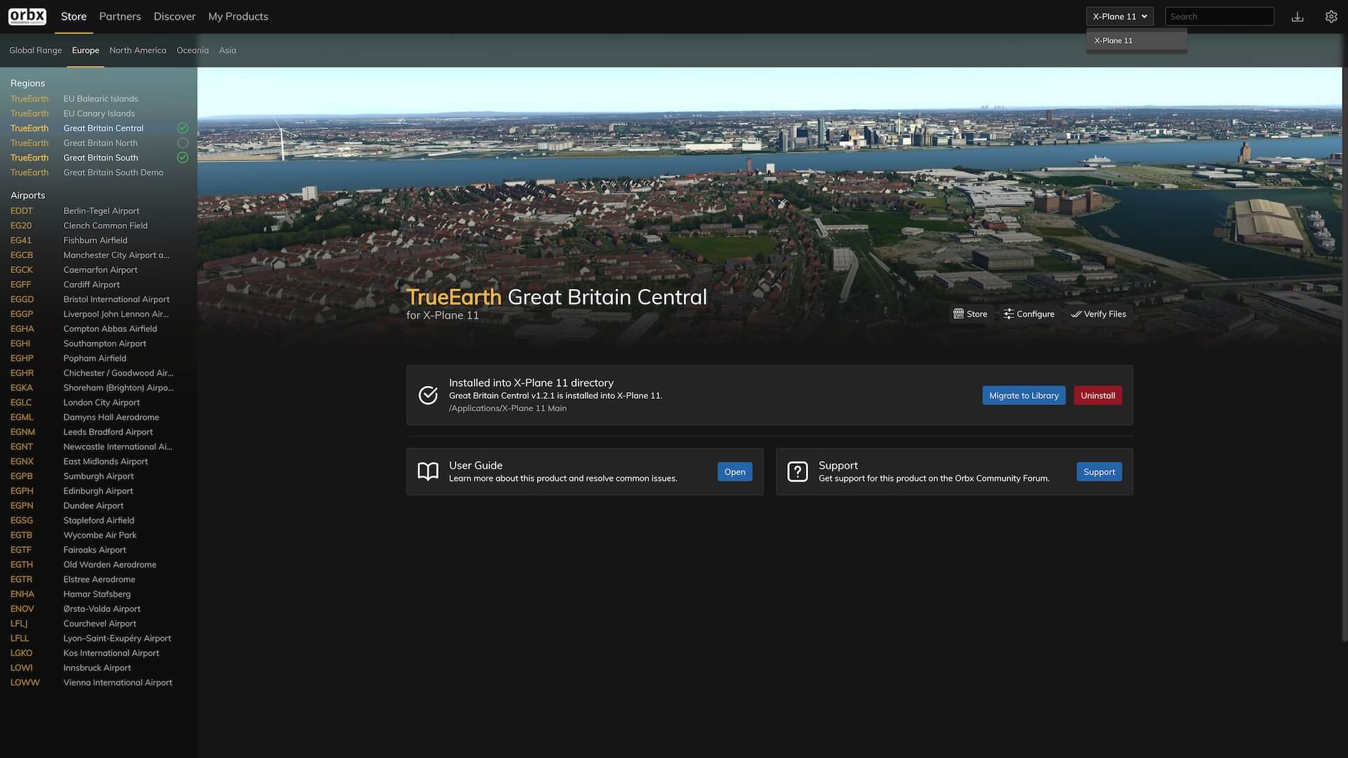
The scenery can be bought either through the Orbx website – orbxdirect.com – or their app Orbx Central. This can be downloaded by clicking a button, the green “Get Central”, top right on the Orbx website, or at this Orbx link. In order to make the purchase the user has to set up an account with a user name and password. This is straight forward and the website or the app take the user through the process.
The website states that the initial download of the package is 20.10 GB and the installed product is 103.69 GB. Orbx have their own download process via their Orbx Central App. Whether the product was bought on the website or the app it is the app that is used to download the scenery.
Once signed in the app shows the scenery as available and then takes the user through a series of prompts to initiate the download. The download can be made directly to a copy of X-Plane or elsewhere, another drive for example, which Orbx terms a library. The software creates automatic links to a nominated copy of X-plane. The library option is useful in the fact that it allows storage away from the main copy of X-Plane and because the scenery is a large amount of disk space this may be an advantage.
If the user has more than one copy of X-Plane care should be taken to direct Orbx Central to the correct copy. If it transpires it has gone to the wrong copy there is a square to the top right of the app display which contains the word X-Plane. By clicking on that the app identifies all copies available. If the cursor is hovered over those options the identity of each one is revealed.
Clicking on the appropriate description points the app towards it. It is also possible to create a “library” at any time and retrospectively store the scenery there. The process is intuitive and easy to follow and the software does all the intricate work.
The download is a large file and does take some time but installation is completed by the app and produces several Orbx folders in the appropriate custom scenery folder. The user manual can be downloaded through the app or through a web search. The manual has a date of December 2018 on the front but still covers all necessary information.
The guide consists of twelve pages and covers product features and requirements, quick installation, scenery coverage, the product control panel, product support and the True Earth team. The control panel allows the user to configure the scenery. This configuration allows the product to be set up with default X-Plane roads or photoreal roads. If the user chooses photo-real roads there are small adjustments that need to be made to roads folder in the Orbx overlay folder.

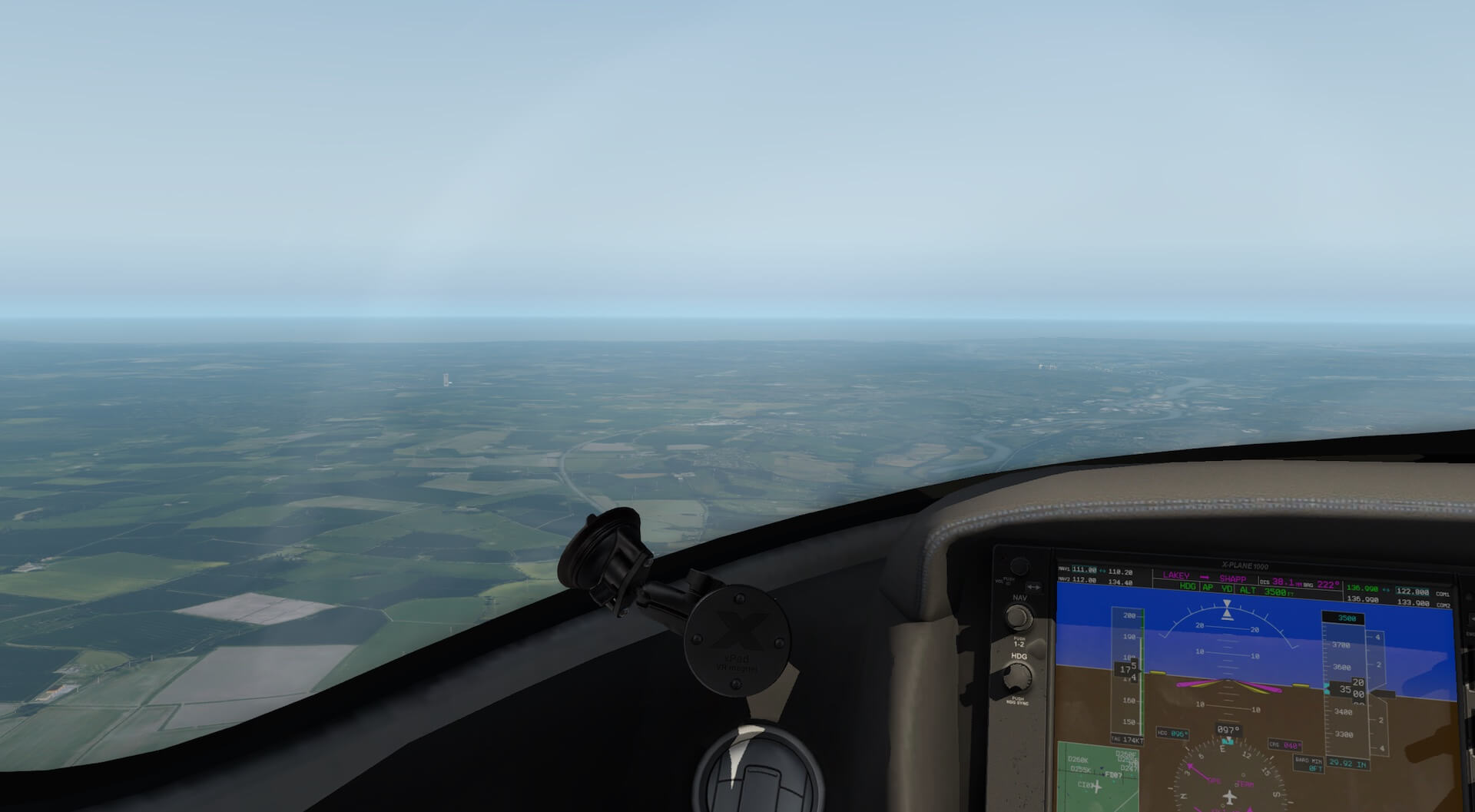
Once installed the scenery opened smoothly although it did take longer for X-Plane to open. I accept that there is far more information to load and it may also be due to the limitations of my hardware but users should be aware this may be the case. There was no effect on frame rates.
Scenery Impression
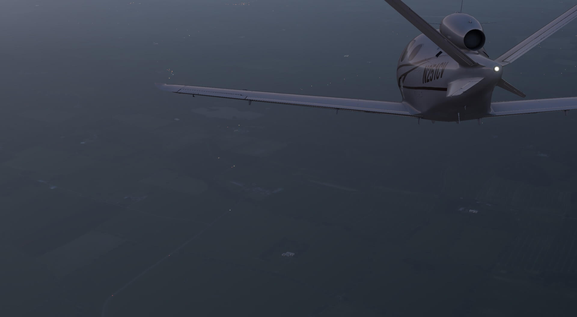
I have tried to visit different locations and places of interest whilst exploring the scenery. In addition Angelique has kindly created a movie of a flight from the Humber estuary, across the Peak District National Park, to Manchester and Liverpool, before crossing in to Wales over Snowdonia National Park finishing in Anglesey. The link to this flight is provided later in the review. The flight is a great illustration of the scenery in action and how it appears from the aircraft.
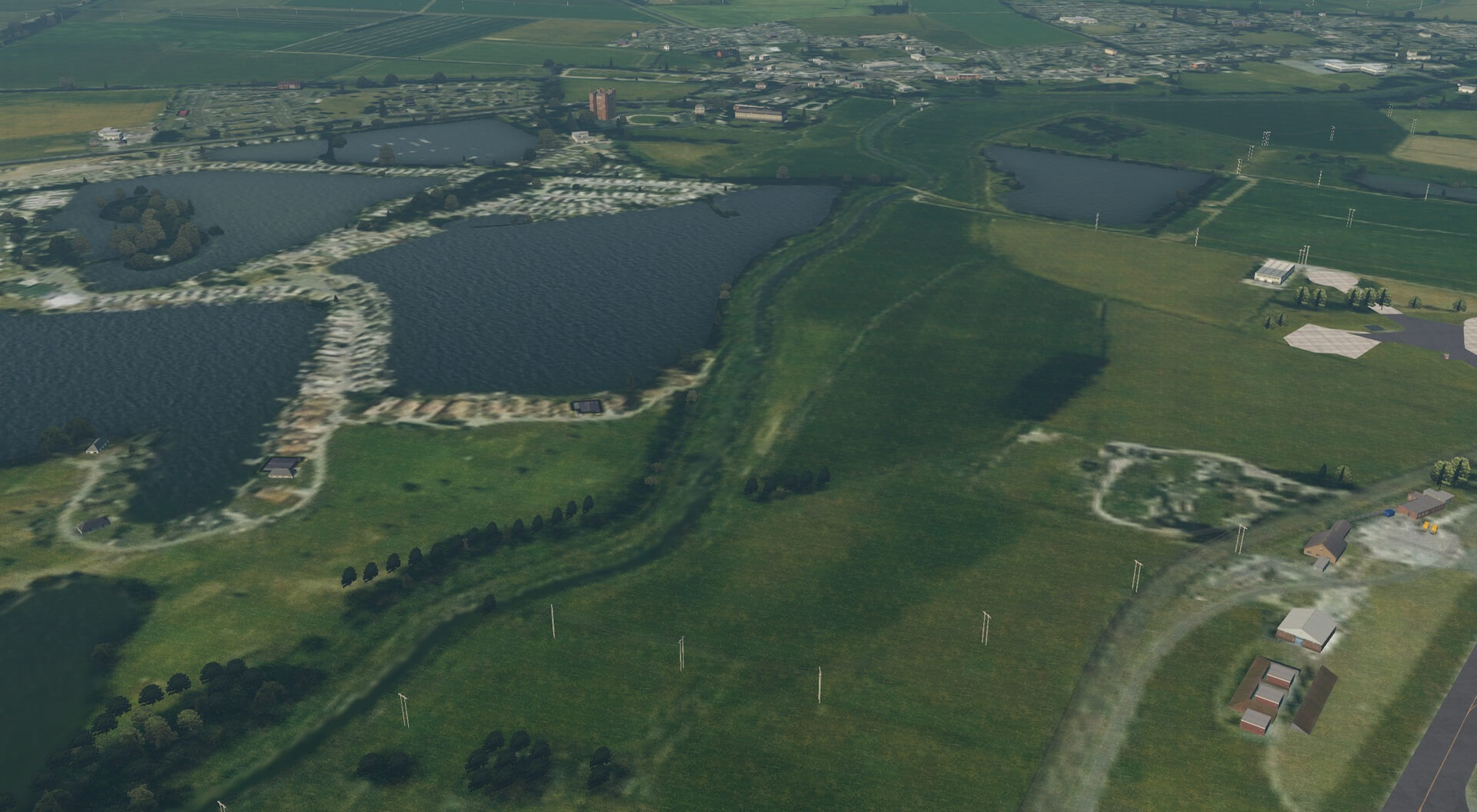
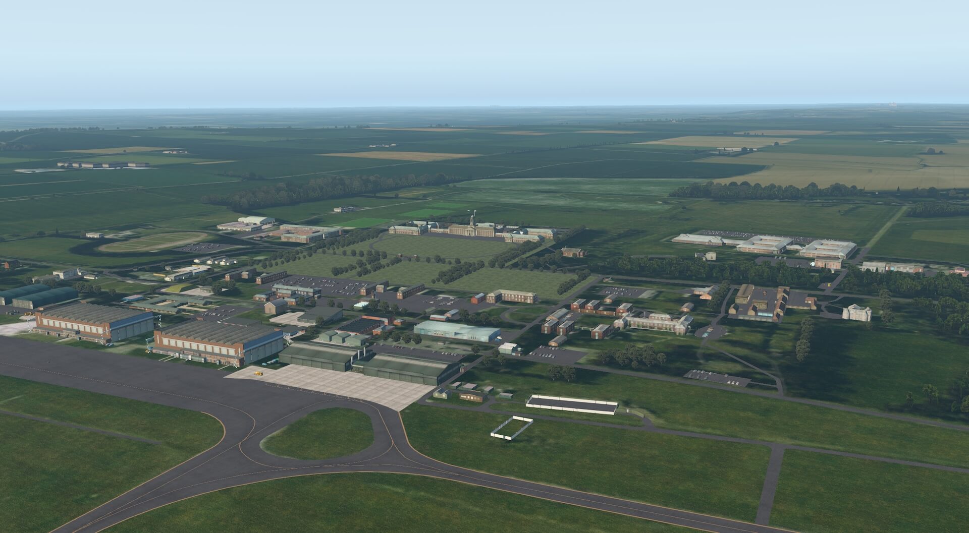
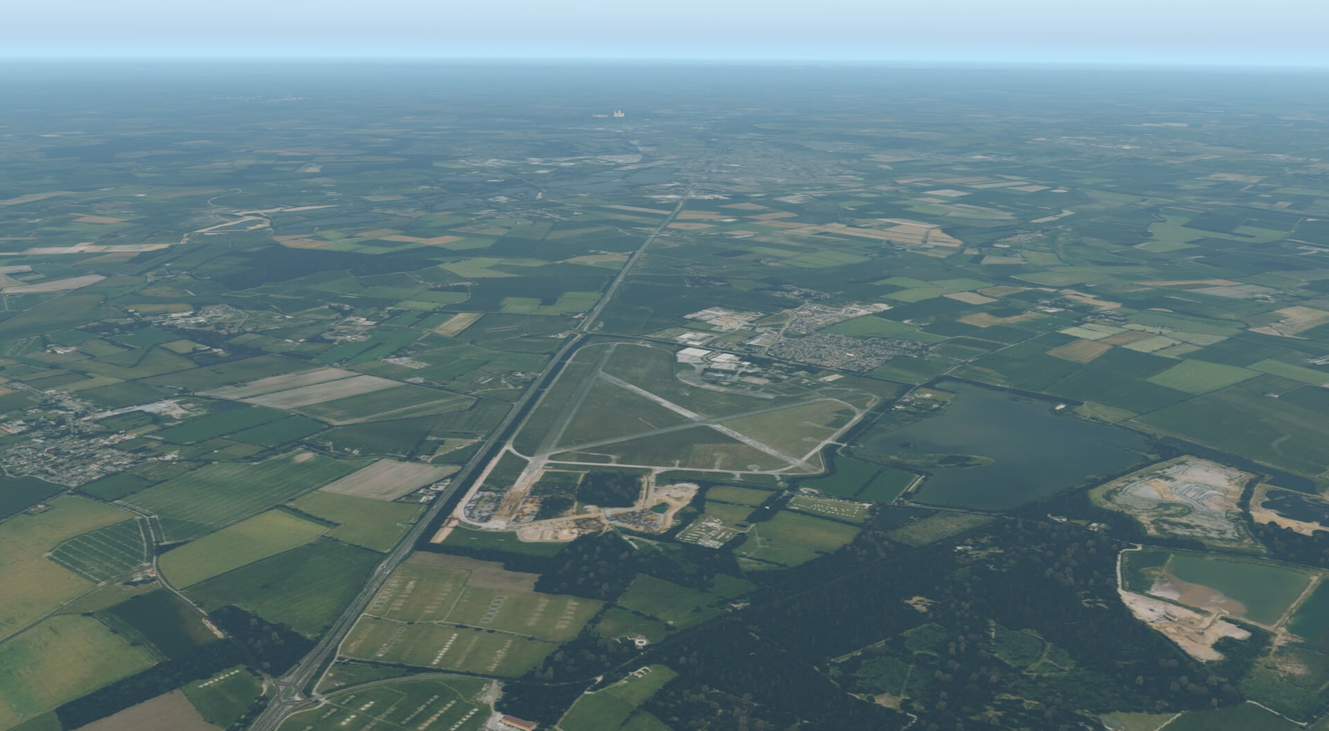
The new scenery is immediately apparent on taking off in the area covered. I then loaded an aircraft at RAF Coningsby as I knew this was modelled in detail before loading GB Central and wanted to see if the scenery worked together.
I could see no problems with the new scenery and the airfield and the two blended well together. The trees on the boundary were modelled and worked well with the airfield itself and nearby Tattershall Castle was modelled in detail.


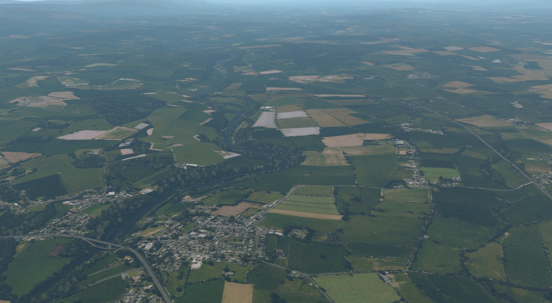
I loaded an aircraft at RAF College Cranwell and easily used VFR to fly the short journey to the village where I grew up. The location is rural and the village is relatively small and so I did not expect too much detail. At 4000ft some buildings were still specifically modelled and the road layout and areas of trees were easy to recognise.
I could identify the paddock next our old house! I continued the flight over nearby Newark on Trent and easily recognised the road layout and features of the town. Houses and streets were realistic and particular buildings such as the town hall were recognisable.

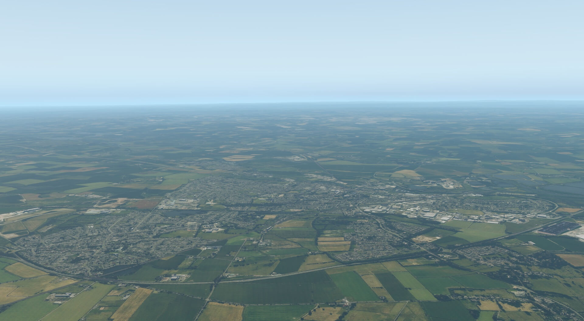
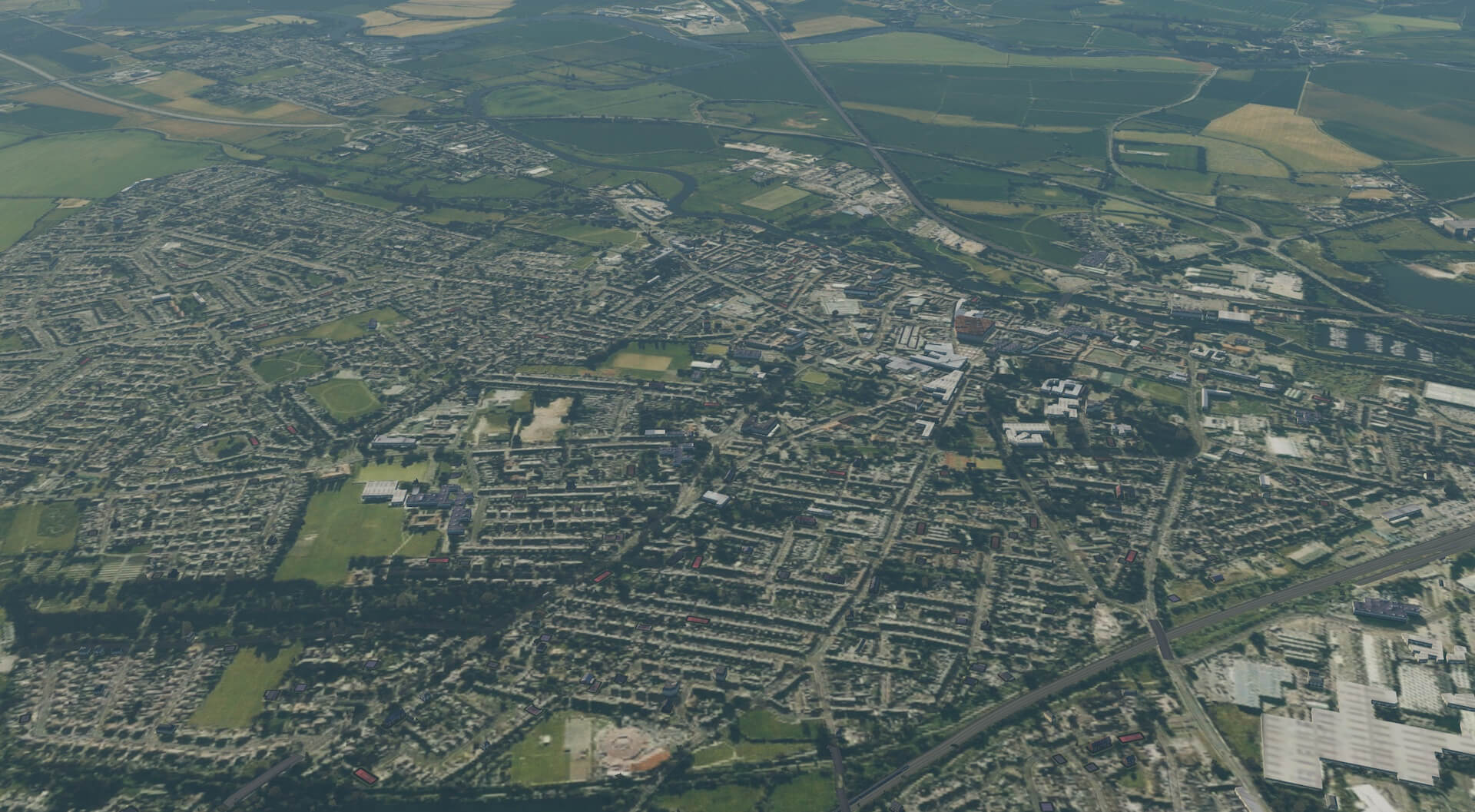
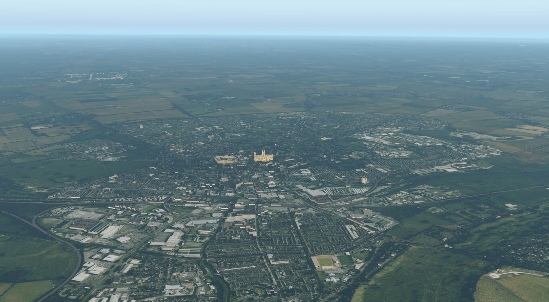
I then turned towards the north easily following the A46 Fosse Way towards Lincoln. VFR navigation was easy using the view of the cathedral and castle in the distance and the old RAF Swinderby en route.
Textures and colours were very well produced and water effects were impressive. Closer in to the city the cathedral and castle were modelled in detail to a high standard and RAF Scampton, the airfield used for the Dambusters raid, can be seen in the distance to the north.

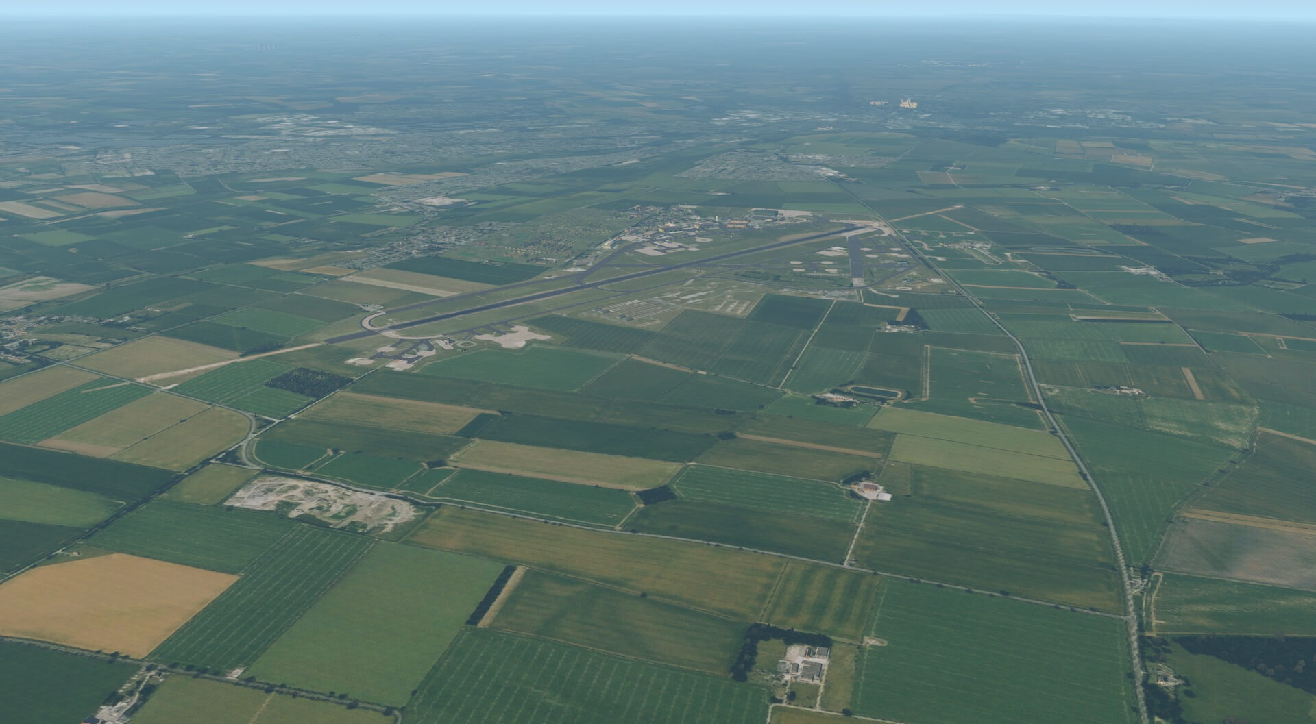
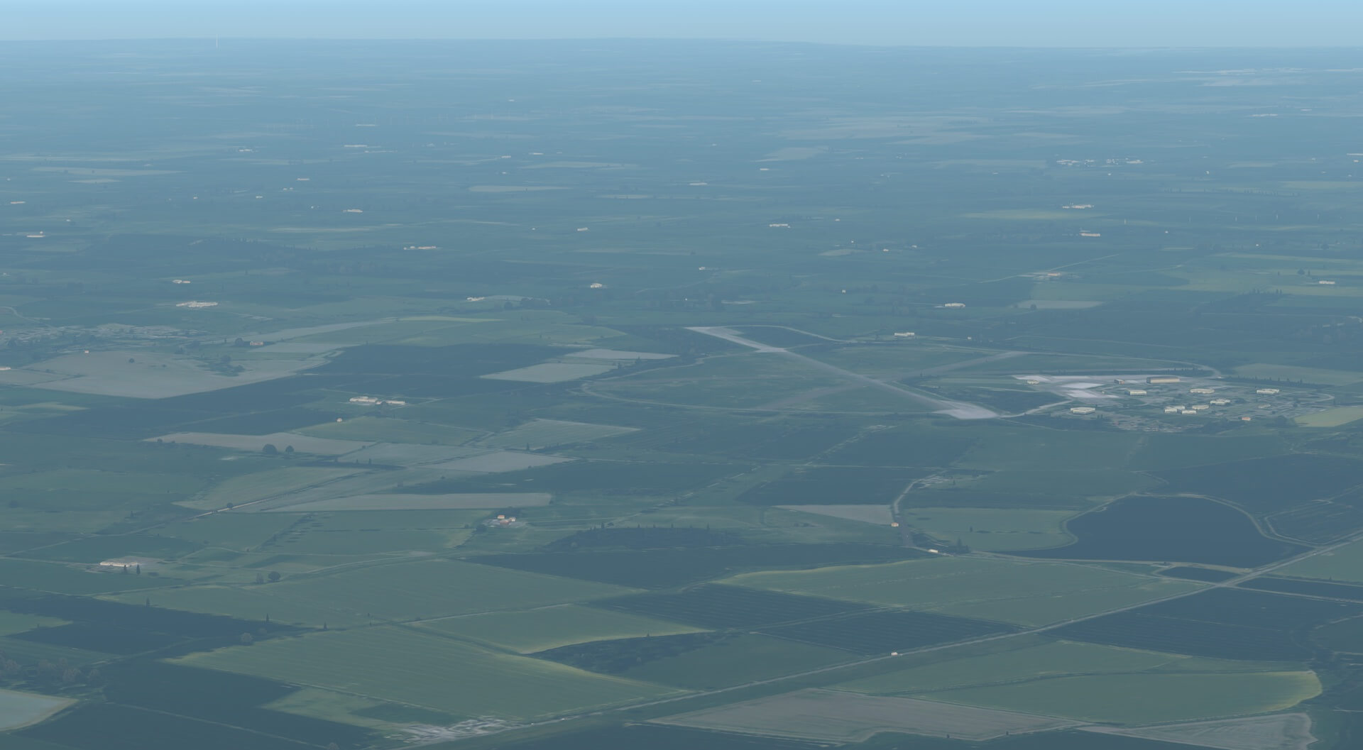
I then turned back and flew over RAF Waddington to view how airfields and airports fit with the scenery when approached. The site was clear and the new scenery did nothing to change the view and clarity of the runways and taxi-ways.

The flight illustrated how beneficial this highly detailed and accurate scenery is to VFR flights either using maps and charts or indeed through local knowledge.
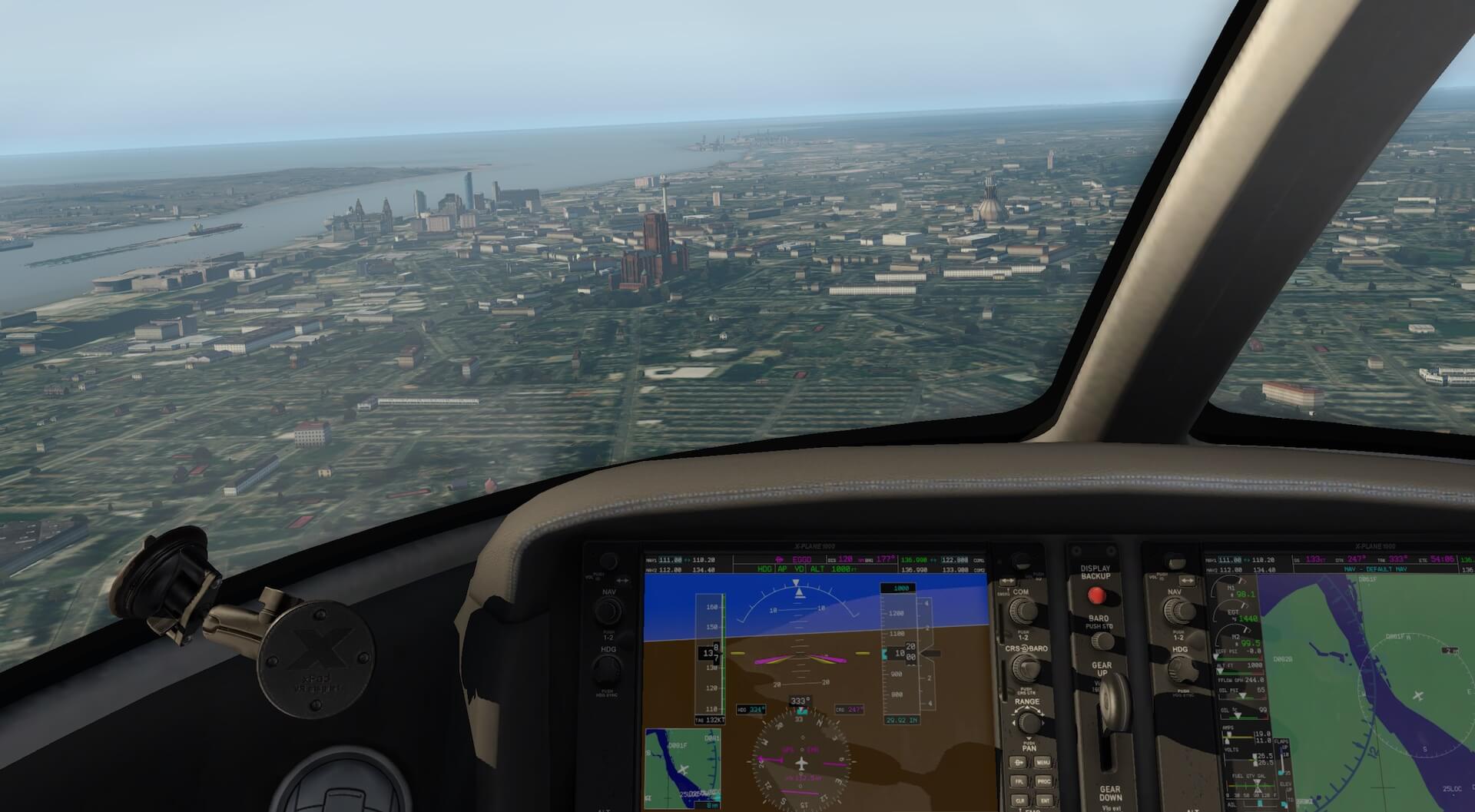
I flew over Liverpool to view the docks area and landmarks. I did the same flight and increased the altitude, starting at 1000ft.


Then 2000ft:


Then 4000ft:

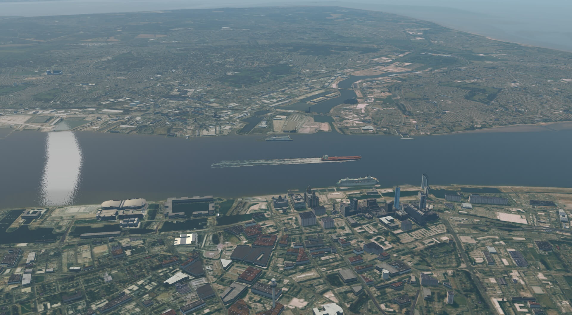
The specifically modelled buildings remained clear and crisp from all altitudes and, as would be expected, the lower altitudes revealed the most detail on those buildings. The more generic buildings actually assumed a greater realism at higher altitudes where their comparative lack of detail was not so pronounced, whilst the modelled buildings gave the scenery depth.
The distant views remain realistic and clearly the distance that can be viewed in to the scenery increases with height. At all altitudes the scenery was impressive and immersive, and improved the experience and view from the cockpit. Traffic was moving on the roads on the correct side for the UK.
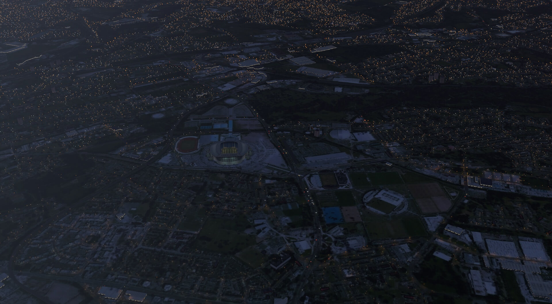
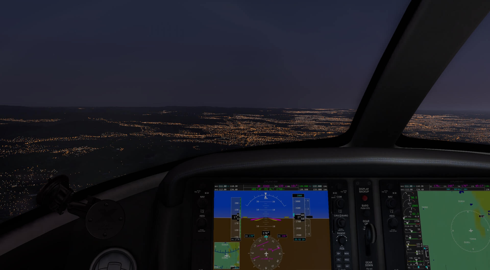
I also overflew the Manchester area to see how the night time scenery worked. The view was very interesting with some buildings lit more brightly than others, some only lit on some floors and some unlit. This provided a varied and realistic view both in commercial areas and residential areas.


Certain items added extra detail such as illuminated sports stadiums. The traffic on the busy roads moved realistically and even in built up areas there were patches of darkness, the lighting effects are not overdone. The lighting across more rural areas is sparse and not as intense as the urban areas as would be expected.

Detail
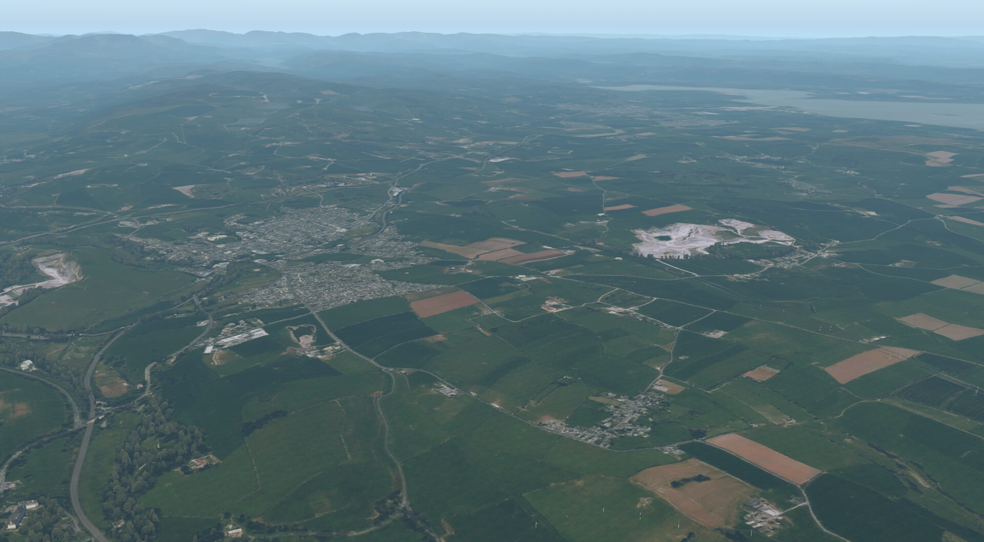
Given the size and coverage of the scenery it is impossible to cover every iconic building and every area. The introduction to the product states that particular detail is added in the more built up areas, iconic sites and coastal regions.
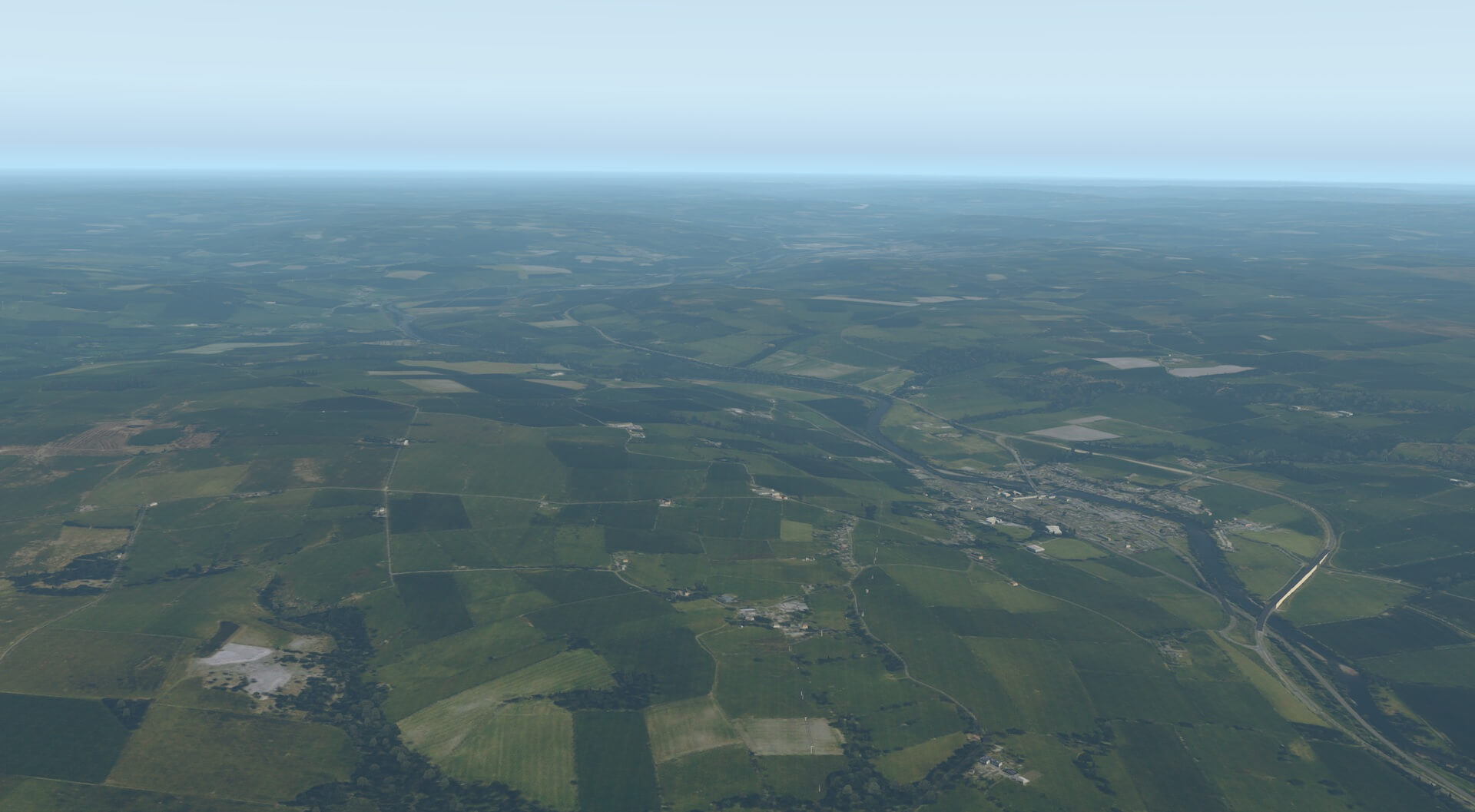
I tried to fly at different altitudes to establish how the scenery looks at different heights and look at how an X-Plane recreational user can benefit from this great scenery package and how the scenery contributes to VFR flight. My family own a farm in rural Northumberland so I decided to fly out of Newcastle airport and use the scenery with Google Maps to navigate to the farm.
I found this very straight forward with roads following the same route, and bodies of water having the same shape, as those on the map.
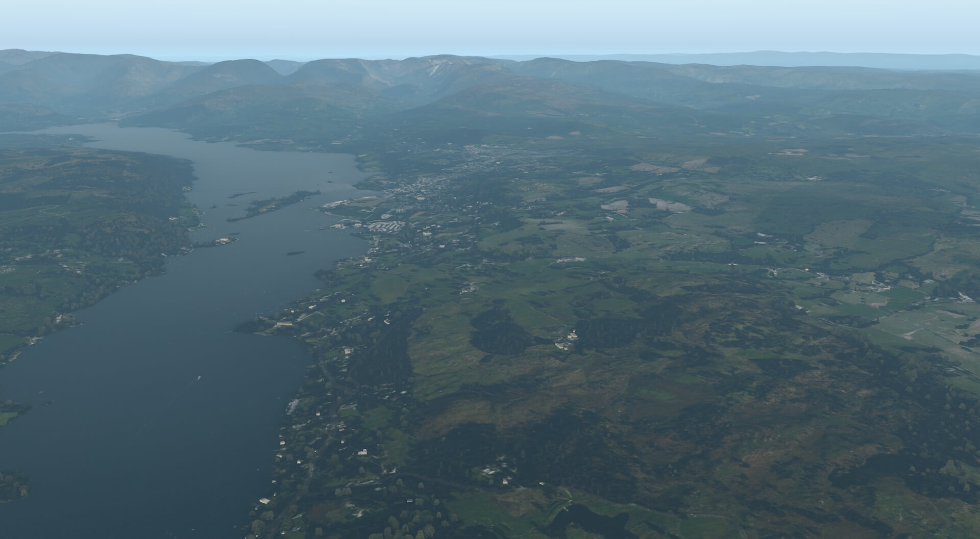
I then took a flight from Barrow in Furness, Cumbria, across the Lake District National Park, across northern England to Newcastle. The textures of the water of the coast and estuaries were very impressive. The different depths of water show through different colours and buildings, countryside and roads are clear and easy to recognise.


Having left the airport I turned north to fly up the length of Lake Windermere. This enabled me to look at the water effects in conjunction with buildings, roads and the mountainous background. All were very impressive, blending well together and with a multitude of colours, textures and detail.


I did most of the flight at 3500 ft but did climb to fly over Helvellyn. The scenery was very realistic with the contrast between vegetation and rocky areas clear and crisp. The textures were very effective and such things as the various footpaths were visible and distinct.

I reduced altitude again to fly over Ullswater and the various parts of the scenery blended well and the modelled buildings added depth. I found that the scenery not only added extra realism and enjoyment to the flight but also created the atmosphere of the lakeland area and made the flight very immersive.


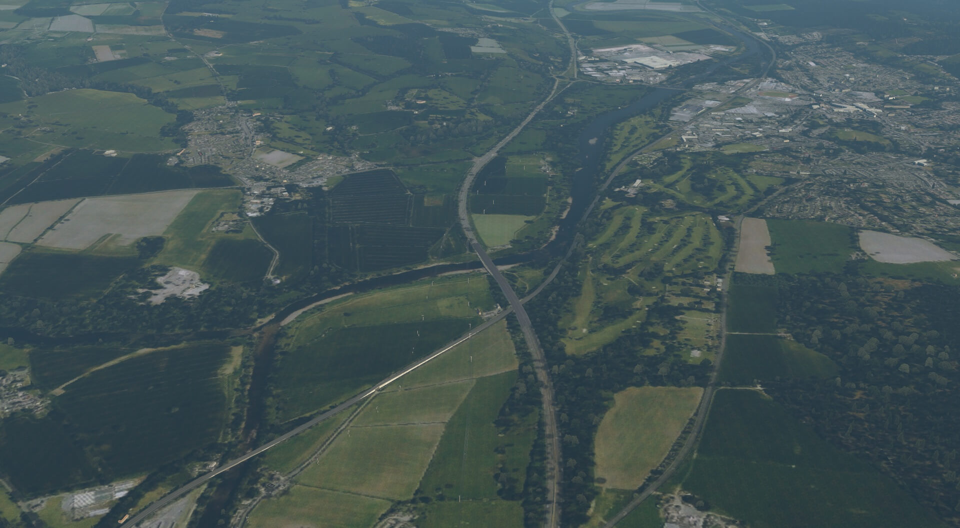
On reaching the edge of the Lake District at Penrith I was able to follow the main road, M6, below to travel north. The area was much flatter with various crops in fields and some inhabited areas with more buildings.
The whole view fitted together and created stunning realism. The scenery below included a motorway, railway and minor road alongside each other. They were all very discernible and distinct from one another. I was able to plan my turn using a map, ready to head east to Newcastle.


My chosen route then required me to follow a more minor road and a river to take me across country. This was easy and interesting to do given the quality and variety existing in the scenery. I followed the South Tyne until it met with the North Tyne and joined to become the River Tyne.
The settlements, houses and farms in the area all looked very good and the detail added real interest to the flight. I was also able to see the WW2 airfield of RAF Ouston which is now used by the army and noted it was duly modelled as a military site.

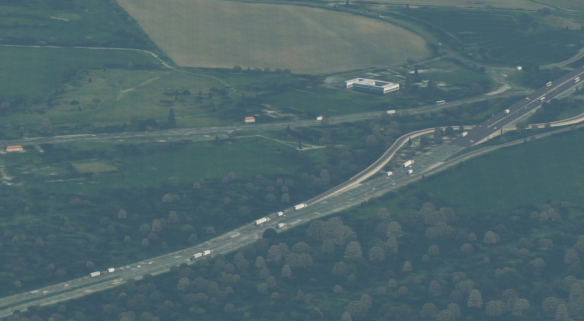
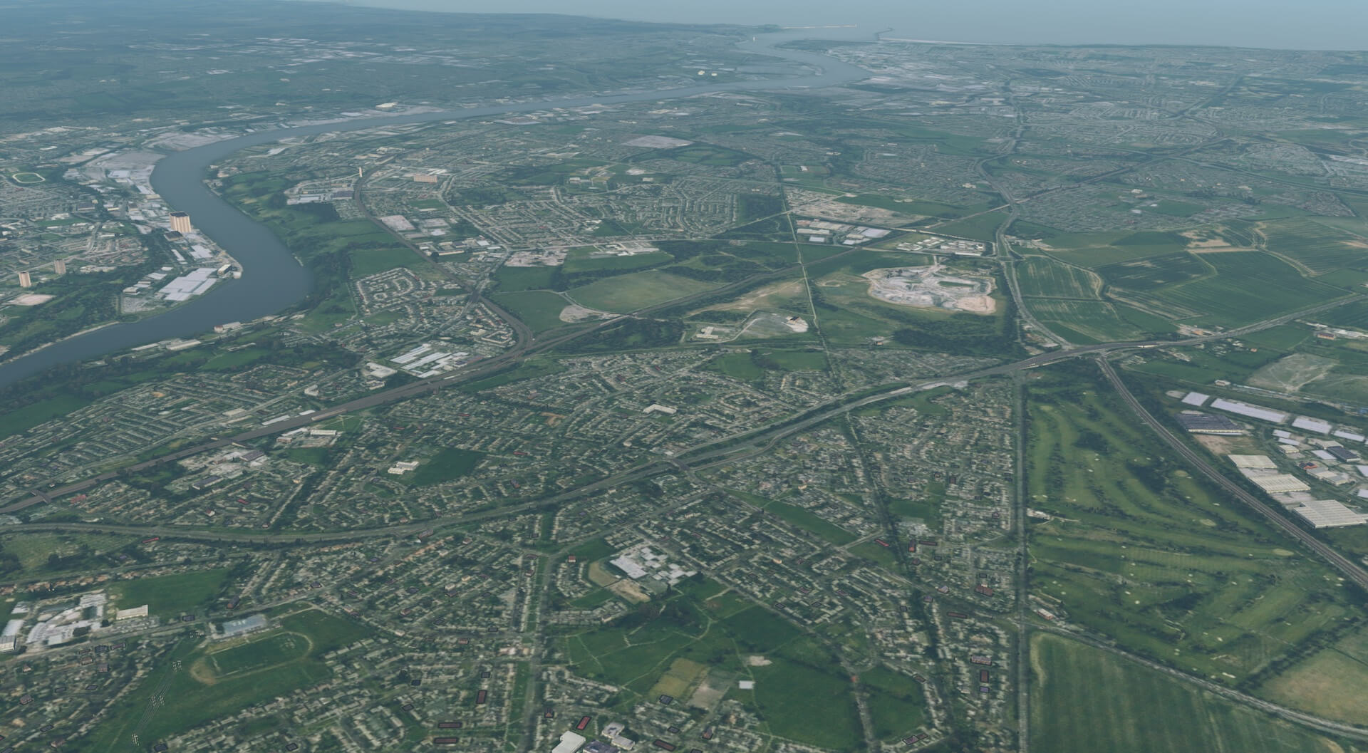
The clarity the scenery provides was also evident on the approach to Newcastle with Newcastle Airport clearly visible amongst the surrounding area. A small detour south allowed me to fly over the “Angel of the North” before turning back north towards the city to take in the iconic bridges over the Tyne and beyond to the modelled St James Park stadium and the Tyneside area.

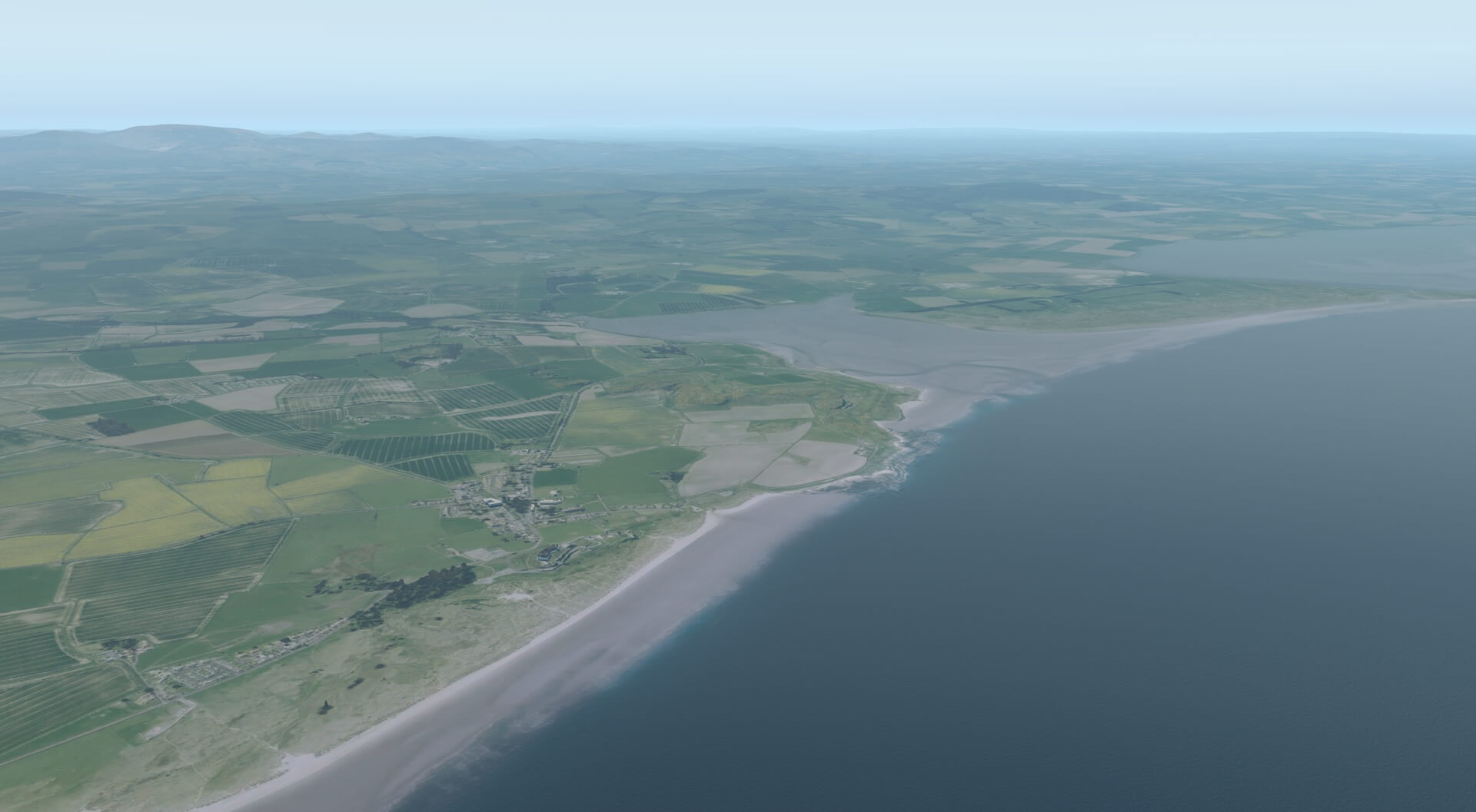
I decided I would then follow the coast north to assess the coastal detail. This worked very well and the sea effects and the coastal detail recreate the tidal zone very well. Settlements alongside the sea mix well and the modelled buildings make the busier areas stand out. VFR navigation remained straight forward and enjoyable and I finished the flight just before the edge of the scenery package looking down on Bamburgh Castle and the Holy Island of Lindisfarne.


This flight may well have been possible with X-Plane generic scenery but VFR flight would not have been as detailed given the detail provided by Orbx True Earth. The whole flight becomes alive as the user takes in the stunning detail and looks for the next landmarks, iconic site, road or water layout with confidence.
In order to illustrate this further this is the link to the movie of the flight created by Angelique, as mentioned in the introduction. Enjoy the flight.
Conclusion
My conclusion is similar to that I provided for Orbx True Earth GB South. The quality and detail is at the same standard across both products. There is a great temptation to just keep on flying over this scenery, interested in the next detail to be viewed.
The standard of presentation certainly is a game changer in terms of flight experience and creates another reason to simply get in a plane and fly. The package not only assists greatly with VFR flight it makes the flight truly immersive adding real atmosphere to the surroundings. Not all buildings are modelled in detail but even those not given special attention are in the correct place and add to the view.
Settlements are recognisable from particular buildings and also road layout. In terms of navigation all settlements reflect the same “footprint” as those on the map and so can be identified. The detail, colours and textures are realistic and effective and blend well together. I have found no difficulties created by third party scenery working with this product.
It is a big download and takes considerable space on disk and I did find that X-Plane took a little longer to load whilst reading new scenery files, but this was not a problem and there is a lot more detail to be loaded. Once using the scenery there is so much to explore and view that it is a really enjoyable and immersive experience.
Flights run smoothly once loaded, as can be seen from Angelique’s movie, and there are no areas where detail is reduced. A thoroughly impressive package which adds so much to the X-Plane flight experience.
More TrueEarth GB Central information can be found at the dedicated Orbx Direct store page. As of this writing, April 2021, Orbx GB Central cost you roughly 29 Euro or 34.00 USD.
Also on behalf of Andy, we hope you like the contents of his review as well as the video, and that whenever you don’t have TrueEarth GB Central yet, it will stimulate you to buy it.
Feel free to contact me if you’ve got additional questions related to this impression. You can reach me via email Angelique.van.Campen@gmail.com or to Angelique@X-Plained.com.
With Greetings,
Andy Clarke
| Add-on: | Payware Orbx TrueEarth GB Central |
|---|---|
| Publisher | Developer: | Orbx | Orbx |
| Description: | Realistic rendition of the mid of the United Kingdom |
| Software Source / Size: | Download / Approximately 104GB (unzipped) |
| Reviewed by: | Andy Clarke |
| Published: | April 4th 2021 |
| Hardware specifications: | - iMac Intel i5 27" - 3.5 GHz Intel Core i5 - AMD Radeon R9 M290X 2048 MB - 16 GB 1600 MHz DDR3 RAM - Logitech Force 3D Pro |
| Software specifications: | - macOS Big Sur 11.x - X-Plane 11.5x (64 Bit) Private Use - A variety of freeware and payware airports |
0 Comments